Four dead in Alabama after ‘flash flood emergency’ in Birmingham and a foot of rain
Oct 7, 2021 | Source: washingtonpost.com


Residents of the Birmingham, Ala., metro area were urged to move to higher ground overnight after more than a foot of rain fell in parts of the region. Stalled thunderstorms with extreme rainfall rates hovered in the area for hours, spurring numerous water rescues and even prompting the issuance of a rare top-tier “flash flood emergency.”
The most serious rainfall was observed just south of Birmingham in Jefferson and Shelby counties, with totals in the double digits after precipitation fell at rates topping three inches per hour. The Shelby County Coroner’s Office told The Washington Post that two 23-year-olds, a man and a woman, were found deceased in their car that was swept away by floodwaters.
Two more people died in the flooding in Arab, Ala., which is about 60 miles northeast of Birmingham, where radar estimated six to seven inches of rain fell. The Marshall County Coroner’s Office confirmed that the bodies of a 4-year-old girl and an 18-year-old woman had been recovered.
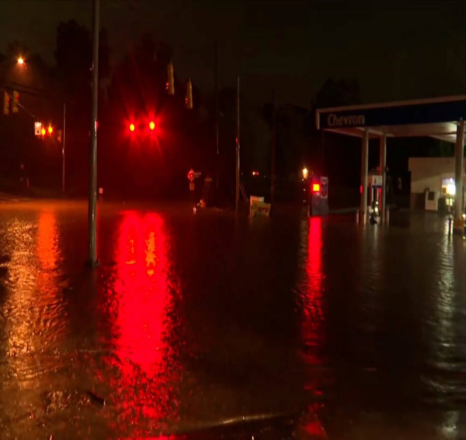
Amid the torrents Wednesday night, the National Weather Service in Birmingham warned “[n]umerous roads are impassable and many structures have water in them. Move to higher ground if you are in any of these areas.”
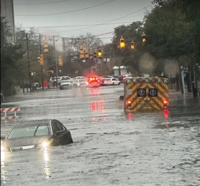
Police scanners were reportedly buzzing “nonstop with calls for assistance” as rising water transformed roadways into rivers, entered homes and rendered some neighborhoods inaccessible.
“Please remain at home!” urged the Weather Service in Birmingham. “Do not enter floodwaters if you’re already out traveling … THIS IS A LIFE-THREATENING SITUATION!”
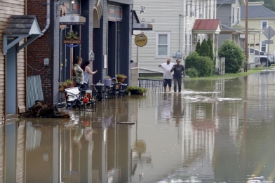
Water gushed into the Lowes hardware store in Hoover, at the Jefferson-Shelby county border, carrying gardening supplies and loose items down aisles. Vehicles parked near shopping centers disappeared beneath the rising waters.
Photos posted to social media show water up to 5 feet high in homes, inundating kitchens and living rooms and forcing families to seek refuge on the second floor.
The Weather Service wrote that the event consisted of four individual rounds of rain, each progressively bringing bigger impacts.
A flash flood warning was issued at 7:17 p.m. and upgraded to a desperate flash flood “emergency” at 8:44 p.m.
James Spann, the chief meteorologist at ABC 33/40 in Birmingham, noted that “last night’s event produced comparable, if not greater rain totals” in Birmingham than the city’s record of 9.75 inches, which fell on Sept. 16, 2004, in association with the remnants of Hurricane Ivan.
Spann noted that the areas impacted Wednesday night were rather small, but had a high population density, translating into a high-impact event.
Doppler radar estimates that the greatest totals were found just 12 miles south of the center of Birmingham, primarily in the areas between Hoover and Pelham to the south along Interstate 65 and Alabama Highway 31. Radar-derived totals were estimated between 11.7 and 13.4 inches.
The heaviest rain appears to have fallen between high-precision airport rain gauges to the north at Birmingham-Shuttlesworth International Airport and west in Bessemer, but members of the public working as cooperative observers reported high-end rainfall. One observer reported 10.21 inches in Pelham’s Little Oak Ridge Estates, while another report of 9.36 inches was received to the northwest near the Indian Estates Lake. One personal weather station in Hoover logged 14 inches.
A foot of rain in 24 hours in Pelham is considered a 200-year rainstorm.
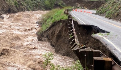
That same area was slammed March 25 by an EF3 tornado, which injured five people during its 50-mile rampage. It was on the ground for more than an hour and had winds to 140 mph.
With the addition of Wednesday night’s rain, Birmingham has already recorded 7.63 inches of rain this month, making it the sixth-wettest October on record with more than three weeks left. Birmingham has seen 22 days this year with at least one inch of rain, just four shy of the record set in 1973 with nearly three months left.
Meteorologists had been forecasting the potential for heavy thunderstorms and flash flooding before the first drops of rain even fell. The National Weather Service had outlined the area as being beneath a “slight” risk of flash flooding and excessive rainfall, corresponding to a Level 2 out of 4 threat. A Level 3 out 4 “moderate risk” was drawn to the northeast near the southern end of the Appalachians, where initial forecasts called for terrain to enhance thunderstorm activity and rainfall rates.
The Weather Service’s Weather Prediction Center, which specializes in working to pinpoint areas most at risk of extreme precipitation, issued a special outlook for northern Alabama as early as 3:45 p.m. Wednesday, within which they noted a likelihood for “scattered instances of flash flooding.”
Instigating the heavy rainfall has been a “cutoff low,” or lobe of cold air, low pressure and spin pinched off from the jet stream, that has stalled over the Central United States for days. Because it is no longer connected to the jet stream, there’s not much to move it along, so the parent system remains parked while trucking warm, moist air north ahead of it. That’s been helping bring rain and storms to much of the Southeast.
The large circulation of the low-pressure zone has enabled it to draw moisture-rich air from deep in the tropics.
Even ahead of Wednesday night’s episode, Birmingham had seen nearly five inches of rain in just the first week of October, which saturated the ground and set the stage for exacerbated flash flood concerns.
The counterclockwise flow around the low-pressure system also meant most individual thunderstorms were traveling due south to north while gradually building eastward. That south to north motion meant that any cells that formed along a south to north stationary boundary draped across north-central Alabama could “backbuild” and train, or move along the same areas continuously, leading to staggering totals.
The Birmingham flooding follows numerous other extreme rain events in recent months throughout the Northern Hemisphere. Earlier this week, a deluge in northwest Italy unleashed 29 inches of rain in 12 hours, a record for Europe.
Scientists have found that human-caused climate change and the resulting rising temperatures are intensifying heavy downpours.
In its review of the science published this summer, the Intergovernmental Panel on Climate Change reported that heavy precipitation events have increased since the 1950s over most land areas. With more warming, the panel projects, heavy precipitation events will intensify further, increasing by 7 percent for every 1.8 degrees Fahrenheit (1 Celsius) of warming.
A flash flood watch remains in effect for much of northern and eastern Alabama and northern Georgia and has been extended into the western Carolinas as the cutoff low lumbers northeastward.
On Thursday, the heaviest rain is forecast to concentrate in northeast Georgia into extreme western North Carolina, including Asheville, where the Weather Service has declared a moderate risk of excessive rainfall.
On Thursday morning, flash flood warnings were in effect just to the northeast of Asheville, where two to five inches of rain had fallen and “life-threatening” flash flooding was underway.
By Friday, the heaviest rain is forecast to shift toward southwest Virginia and central North Carolina although its intensity may ease some and the Weather Service has characterized the risk of excessive rainfall as “marginal.”