Ida’s Inland Path May Reveal Hidden Risk, Test Mapping Methods of Hurricane Floods
Sep 2, 2021 | Source: insurancejournal.com


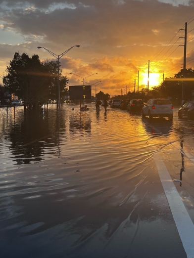
With remnants of Ida delivering downpours and fierce winds from North Carolina to New Jersey, U.S. government methods for assessing flood risks may be put to the test this week.
While coastal communities would seem to have the biggest risk of flooding and damage from storms, those far from the shoreline can also be at great risk. Emergency officials on Wednesday rushed to evacuate about 3,000 people living near a dam in Johnston, Pa., according the Associated Press, after hours of heavy rain.
Many homes in the mountainous Appalachia region that includes Pennsylvania face peril from inadequate flood protection and a longstanding practice of underestimating storms. That’s where the Federal Emergency Management Agency plays a part. In the U.S., 95% of residential flood insurance is underwritten by a branch of FEMA.
The agency also makes the maps that designate broad flood risk zones and help determine the need for such insurance. If a home is in one of the the severe risk areas, homeowners with a federally backed mortgage must buy insurance from the National Flood Insurance Program.
Yet FEMA’s mapping efforts have been called into question by First Street Foundation, the research nonprofit behind a report last year that evaluated flood risks for every property in 48 contiguous states. Using techniques pioneered by the insurance industry, First Street found 6 million additional homes that should be in the severe flood-risk zones.
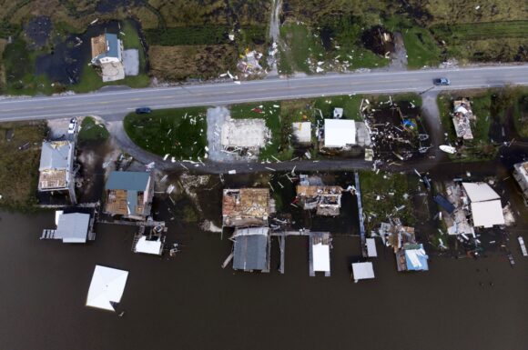
Much of that elevated risk was along the spine of Appalachia, stretching from Georgia and North Carolina through Pennsylvania. Flooding in Tennessee killed at least 22 people in last month, and this week’s downpours from Ida caused flash flood warnings in West Virginia and tornado watches from North Carolina to New Jersey. Earlier this year, the remains of Tropical Storm Fred caused flooding so dangerous that counties in North Carolina reported homes being ripped from their foundations.
First Street’s flood risk assessments show that there were as many as 19% more homes at risk in the counties that flooded in Tennessee than federal models showed, according to Matthew Eby, the organization’s executive director. Some counties in Tennessee and West Virginia have as much as 30% more homes at risk in First Street’s data compared to FEMA’s estimates.
“FEMA is constantly working to improve the production of the Flood Insurance Rate Maps,” spokeswoman Jaclyn Rothenberg said in a statement, adding that First Street is taking them out of context as the maps are meant to give a snapshot of risk rather than predict floods. Even though FEMA has updated several maps in these areas, Eby said they still underrepresent flood risks.
Flooding peaks across the southern Appalachian Mountains in late winter to early spring. Researchers have found a second increase in annual deluges occurring between August and October, which is likely due to the remnants of tropical systems, according to report by the National Weather Service.
“These maps still don’t directly take into account precipitation flooding or the impact heavy rains have on small waterway flooding,” First Street’s Eby said. In other words, just the kind of flooding caused by hurricane tails.