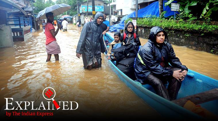
For the second year running, Kerala is in the throes of floods and a series of subsequent landslides that have claimed over 90 lives. More than 2.5 lakh people are in relief camps, and more rain has been predicted in the next couple of days by the Meteorological Department. Unlike last year, the damage is heavy in the northern districts this year — particularly in Malappuram and Wayanad, where landslides are feared to have killed dozens.
In the first two months of the southwest monsoon — June and July — Kerala recorded rainfall deficiency of 40%-50%, and the administration had begun to prepare for a drought situation. Until July 2, the state had received just 365.99 mm rain against the normal of 697.8 mm, a deficiency of 48%.
A weak El Nino along with inadequate strengthening of southwesterly winds were seen as the reasons for the deficient rainfall. Even a month later, on August 3, the deficiency was around 34%, with only two districts — Kozhikode and Kasaragod — having received ‘normal’ rainfall.
But within a week, on August 10, the rainfall deficiency had dropped to just 8%, as the state was pounded by heavy rain over a few days. IMD data between August 1 and August 8 show Malappuram got 189.4 mm against the normal of 114.3 mm, Wayanad got 252.3 mm against the normal 184.5 mm, and Kozhikode got 219.8 mm against the normal of 143.6 mm — departures of 66%, 37%, and 53% from the normal.
What this means that these districts, for which code red rain alerts had been issued by the IMD, got copious amounts of rainfall within a short time, leading to floods and landslips. The movement of a depression from the Bay of Bengal and the formation of a low-pressure area over the coasts of Kerala and Karnataka contributed to the strengthening of the monsoon.
It’s clear that just like last year, when Kerala recorded extremely heavy rainfall in the second week of August lasting just a few days, this year too, there has been inconsistent rainfall throughout the season.
A top IMD official said, “The intensity of rainfall has been high. It is more common nowadays, and we can attribute it to climate change. In the coming years as well, we can expect high-intensity rainfall.”
Disaster management officials say monthly or seasonal rainfall in Kerala may be close to the predictions of a ‘normal’ monsoon made by the IMD. But there are alarming diurnal variations in the amount of rainfall received in just a day.
“If you look at rainfall that we’re supposed to get in 24 hours, that rainfall may be recorded in one hour or even half an hour. So we have to analyse the weather data,” said Nithin Davis, a hazard analyst with the Kerala State Disaster Management Authority.
“It is tied to climate change. The repercussions of climate change and the frequency of extreme weather events is alarming. And we are not alone. We have other southern states like Karnataka, and then Maharashtra (experiencing floods). It began with Assam. Extreme weather events are going to be more frequent in coming years. We are trying to adapt to that reality and we have to look at our development perspectives,” he added.
Unlike the 2018 floods, which were a result of heavy rainfall in the catchment areas of reservoirs and the subsequent opening of dam shutters to drain out excess water into rivers, the calamity this year is more ‘localised’. High-intensity rainfall in low-lying areas and villages located in the Western Ghats led to waterlogging and landslides.