Predicting the risk of flooding in France now and in the future
Jun 23, 2021 | Source: ambientalrisk.com


"We are excited that this data is now available for France, in addition to Spain and Portugal. It is supporting customers in financial services, infrastructure planning and across several other sectors where there is a growing need to understand current exposure to flood risk and sensitivity to climate change impacts in the future."
Paul Drury, Product Manager
The Organisation for Economic Co-operation and Development (OECD) states that nearly one in five French residents live in areas at risk of flooding. Studies have shown that an estimated 4.5 million people are at direct risk of flooding. The overall risk relative to other European countries is fairly low but there are significant parts of the country which are considered to be at high risk. The South East of France has the worst concentrations of risk and in the department of Gard as much as 44% of the population is at risk of flooding.
Flooding is thought to account for around 80% of the total damage which France experiences through natural disasters. By 2030 the value of assets at risk from river flooding is expected to nearly double. Climate change induced sea level rise will increase coastal hazards from flooding and erosion. In the Languedoc-Roussillon region alone the cost of damage linked to “permanent submersion” and erosion hazards without policy change is evaluated between EUR 15 and 35 billion by the year 2100 putting an additional 125,000 homes at risk.
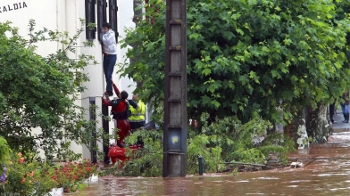
Flooding is a frequent phenomenon in France. Just earlier this month (June 2021) heavy rain caused flash flooding and mud slides triggering widespread road closures and damage to homes, particularly in the departments of Seine-et-Marne, Seine-Maritime, Oise and Meuse. In February heavy and sustained rainfall caused overflowing rivers in Lot-et-Garonne and Charente-Maritime Department. In previous years severely erosive floods have washed away buildings throughout the country and resulted in several fatalities.
Since the catastrophic flooding of Paris in 1910 much work has been done to improve flood resilience of the river Seine which flows through the city, but if a hydrological event as severe or even worse were to occur again in the Ile-de-France region it could have direct and indirect impacts on almost 5 million people, disrupting a large number of businesses, and with significant economic, human and social effects.
Increased storm intensity and rainfall is predicted in the future and this will also lead to increases in the severity of flood risk in France. In addition to flood waters originating from the sea the Ambiental flood data also includes models which consider flood risk from rivers and surface water flooding from flash floods. This data is represented at seven likelihoods of occurrence. This provides a range of severities for analysis, ranging from very high frequency low intensity floods (1 in 20 year return period) through to very low frequency high intensity floods (1 in 10,000 year return period).
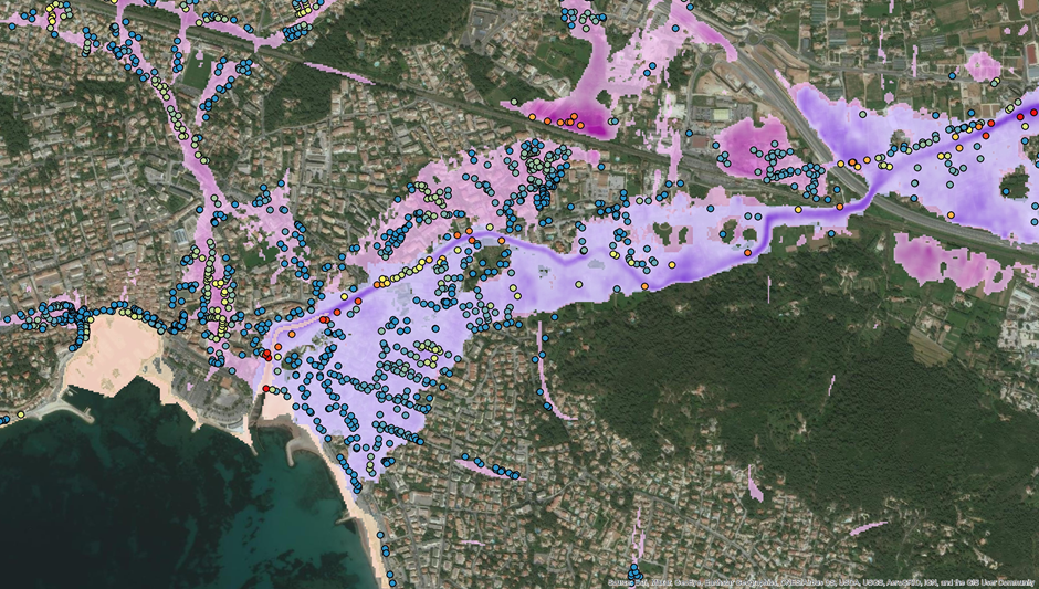
Ambiental’s France FloodMap includes map layers predicting flood depth and extent for the entirety of mainland France. France FloodScore pins flood risk data to all addressable properties and includes risk index scores which are ideal for ranking risks and deriving insurance premiums. France FloodScore Climate includes additional attributes which describe the predicted shifts in flood depths and risks scores as a result of climate change. Based on studies of climate change models from the Intergovernmental Panel on Climate Change (IPPC) it allows analysis of 4 climate change scenarios which consider the range of possible flood hazard outcomes under increasingly severe emissions scenarios and projected decades into the future.
The European flood risk solutions developed by Ambiental are providing insights to existing customers with global operations and reaching new markets within the target countries. For many territories this data represents the most comprehensive and detailed view of flood hazard available. Through parent company Royal HaskoningDHV Ambiental has local offices in multiple European countries. This means that local expertise can be leveraged in the design and verification of flood models and language barriers do not present any barriers to European customers who wish to unlock insights using Ambiental data.
Sample data for FloodMap, FloodScore and FloodScore Climate are available now for evaluation via Ambiental’s sample data downloads webpage. Additional areas of interest are available for evaluation upon request. If you would like to find out more about how Ambiental can support disaster risk management in Europe and beyond contact our experts who can provide more information on how our models and services can help Ambiental and its clients with Enhancing Society Together.