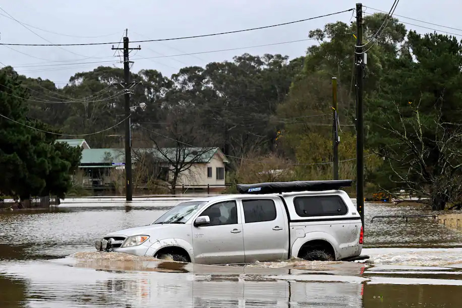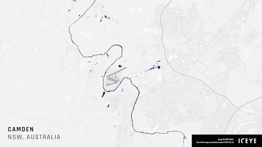
A resident drives through floodwaters along the overflowing Nepean River in western Sydney on July 5, 2022. (Saeed Khan/AFP/Getty Images)
A potent weather system near Australia’s east coast has unloaded tremendous rainfall in the state of New South Wales for days, putting Sydney on track for its wettest year on record.
The torrents have spurred widespread flooding in eastern parts of New South Wales, for the fourth time in less than 18 months. The flooding has triggered more than 100 evacuation orders.
“The impacts are extensive, especially damage to properties, the environment, livelihoods, and the toll on human wellbeing would probably the longest to recover from,” said Agus Santoso, a senior scientist at the Climate Change Research Center at University of New South Wales, in an email. He added he was most surprised “that records continued to be broken since last year.”
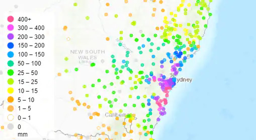
Since Friday, Sydney has observed 8.6 inches (220 mm) of rain, while surrounding areas have seen far more — some approaching 28 inches (700 mm) — which is around the amount London sees in an entire year.
Sydney amassed the same amount of rain over four days that it typically sees in a month and a half, according to WeatherZone, an Australian weather information company.

The city has registered about 70 inches (1,769 mm) of rain this year, leaping 7.5 inches past 1890, its next-wettest year through July 4. And, with nearly five months of the year still to go, it has already clinched at least its 11th-wettest year on record.
Scientists attributed the excessive rainfall to a combination of factors:
The Australia Bureau of Meteorology also noted that warm ocean waters helped intensify rainfall.
“During this recent rainfall event, very warm waters off the Australian coast (21-23°C) provided extra energy and moisture contributing to the deep trough and east coast low, leading to the relative concentration of the heavy rainfall to one 24-hour period,” it wrote.

Although many areas of Sydney recorded about 8 inches (200 mm) of rain over the past week, the heaviest amounts in New South Wales had fallen in Brogers Creek, about 65 miles south of city, where 36.7 inches (933 mm) fell. WeatherZone wrote that such rainfall has just a 1 to 2 percent likelihood of occurrence in any given year.
Darkes Forest, about 40 miles south of Sydney, posted 27.4 inches (697 mm) of rain.
Researchers say climate change is worsening the situation. Australia has warmed by around 2.6 degrees (1.5 Celsius) since 1910. A warming atmosphere holds more moisture and can increase the intensity of extreme rainfall events.
“Australia has long been a continent of droughts and flooding rains; having said that, projections indicate that climate change will supercharge this variability,” Chiara Holgate, a researcher with the Australian National University and ARC Center of Excellence for Climate Extremes, said in an email. “Observations show there’s been an increase in the intensity of heavy rainfall events in Australia, including the short-duration events, which can be associated with flash flooding.”
Much of the region’s extreme flooding since 2020 was exacerbated by La Niña conditions, which left reservoirs and catchments saturated and worsened the flooding, said Santoso. “Climate change is also expected to intensify El Niño and La Niña cycle...even if El Niño and La Niña themselves do not change, their impacts are expected to be more severe.”
Holgate said Australia needs to prepare for more intense flooding events, as floods are one of the most expensive disasters the country faces. Flooding in southeast Queensland and New South Wales in February and March cost about $3.35 billion in insured losses, according to the Insurance Council of Australia — making it the costliest flood in the country’s history.
“Large floods are a threat to water supply and safe drinking water, straining water treatment plant operation by increased sediment load and potential contaminants,” environmental scientist Klaus Joehnk said in a news release.
Researchers have found that climate change has exacerbated several recent flooding events around the world. The World Weather Attribution group found that record flooding Brazil in May, which displaced at least 25,000 people and killed more than 130, was exacerbated by climate change. The group also found that global warming made torrential rains in South Africa in April, which killed more than 400 people, twice as likely to occur and 4 to 8 percent more intense.
Forecasts show the rain may continue for a little while longer. On Tuesday, Australia’s Bureau of Meteorology tweeted that major flooding was continuing across portions of New South Wales, even as it eased in Sydney. More than 20 warnings were active.
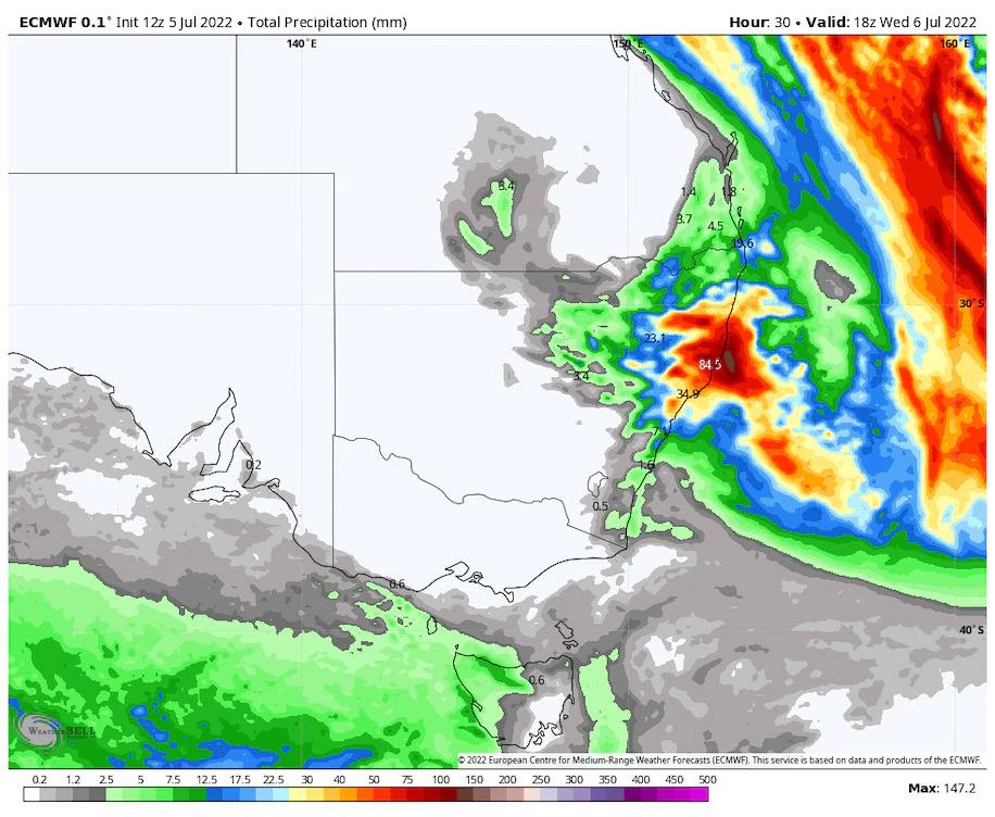
Through Thursday, the heaviest additional rainfall is projected mainly north of Sydney, where the European forecast model simulates up to 1 to 3 inches (30 to 80mm) of additional rainfall.
“Spring is also predicted to be unusually wet, so we may yet see more flooding this year, as any heavy rains that fall will be falling on already saturated catchments,” said Holgate.
