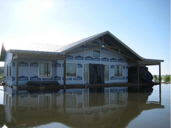
NRDC and the Association of State Floodplain Managers (ASFPM) petitioned the Federal Emergency Management Agency (FEMA) to update the agency’s rules for building and land-use in the nation’s floodplains, and to develop flood maps that project future flood risks.
Flooding—the most common natural hazard in the United States—is occurring more often due to climate change. As the seas rise and storms become more severe, flood risk will continue to increase, presenting grave challenges to our nation’s cities, towns, and neighborhoods.
NRDC and ASFPM are petitioning FEMA to reduce harm to the millions of people and properties already at risk from flooding and that will be increasingly vulnerable in the future. FEMA, through the National Flood Insurance Program (NFIP), has a legal responsibility to set safer standards to better protect people and property from flooding. The nation can no longer rely on the NFIP’s outdated building and land-use standards; standards that are unintentionally placing people in harm’s way.
Ongoing and future changes to the climate, such as sea level rise and extreme rainstorms, combined with growing population density in coastal and other flood-prone areas, are increasing the likelihood of damage and human suffering caused by floods.
Rising sea levels are exacerbating several threats to coastal communities. The projected increases in sea level, average tropical storm intensity, and tropical cyclone rainfall rates will act to further elevate future storm surge risk. By one estimate, the number of affordable-housing units in the United States that are at risk of regular flooding is expected to triple by 2050 as sea levels rise.
The NFIP is the nation’s primary mechanism for addressing the flood-related impacts of climate change. Participating communities must adopt minimum building and land-use standards established by FEMA in order for residents to purchase insurance. FEMA flood maps that depict high-risk flood areas are also adopted by the more than 22,000 participating communities. These maps are the standard to which everyone turns—developers, engineers, banks, local land use officials, and homeowners and buyers all rely on these maps when siting, designing, or financing any project.
FEMA—as the sole administrator of the NFIP—has the authority to issue and/or amend the NFIP-implementing regulations to develop minimum building and land-use criteria for flood-prone areas. FEMA is also responsible for the issuance and approval of the program’s floodplain maps.
Congress mandates that the NFIP’s building and land-use requirements, to the maximum extent feasible, limit development of flood-prone land, and assist in reducing flood damages.
However, FEMA has not comprehensively amended the standards for building and land-use in flood-prone areas since the early 1970’s. As such, not only are the standards ill-equipped to address the floods of today—modern model building codes exceed FEMA’s requirements—the standards are also wholly insufficient to prepare communities for the impacts of climate change.
Congress also mandates FEMA include future conditions, such as projections of sea level rise, whenever it revises and updates NFIP flood maps. These maps govern where and how development and infrastructure is built. FEMA has not included future conditions on any of the 8,000 maps the agency has updated since Congress imposed its mandate. That means communities are making development decisions based on the climate of the past, not the future.
Smart policy and the law both mandate that FEMA revise the NFIP-implementing regulations to adequately account for the increasing risk of flooding due to climate change. Safer and stronger construction and land-use standards—and adequately mapping future conditions—provide communities the opportunity to anticipate and reduce flood risk, saving lives and protecting property.
NRDC and ASFPM are pursuing a petition to request FEMA to publicly respond to this worsening issue. We are requesting FEMA:
The body of science connecting climate change to an increased risk of flooding is clear. Numerous studies, including federal agency reports, prove a substantial connection between climate change and the growing frequency and severity of flood events, which greatly challenge our nation’s cities, towns, and neighborhoods.
Congress created the NFIP to reduce flood damages nationwide and to ease the federal government’s financial burden for providing disaster recovery. However, flood damages and federal spending on flood recovery are rising exponentially, implying the NFIP suggest the program is failing to achieve its primary goal. To reduce future flood damage and ensure people are protected from future flooding and sea level rise, the NFIP must adequately account for the impact of climate change on flood hazards.