Ida Drenches New York and New Jersey
Sep 2, 2021 | Source: nytimes.com


The remnants of Hurricane Ida barreled into the New York City region on Wednesday evening with furious, wind-driven rain that all but halted subway service, splintered homes in New Jersey, raised a tornado warning for the Bronx, and delayed the U.S. Open in Queens when the rain came into the roofed stadium sideways.
The rain on Wednesday night — 3.1 inches in Central Park within an hour — shattered the record set only last week, when 1.94 inches of rain fell in the park during Tropical Storm Henri. The National Weather Service issued a flash flood emergency in New York City for the first time.
At least two deaths were reported in the flooding, one in Queens and one in Passaic, N.J.
Mayor Bill de Blasio declared a state of emergency just before 11:30 p.m., saying New York City was “enduring a historic weather event” with “record breaking rain across the city, brutal flooding and dangerous conditions on our roads.” He warned New Yorkers: “Stay inside.”
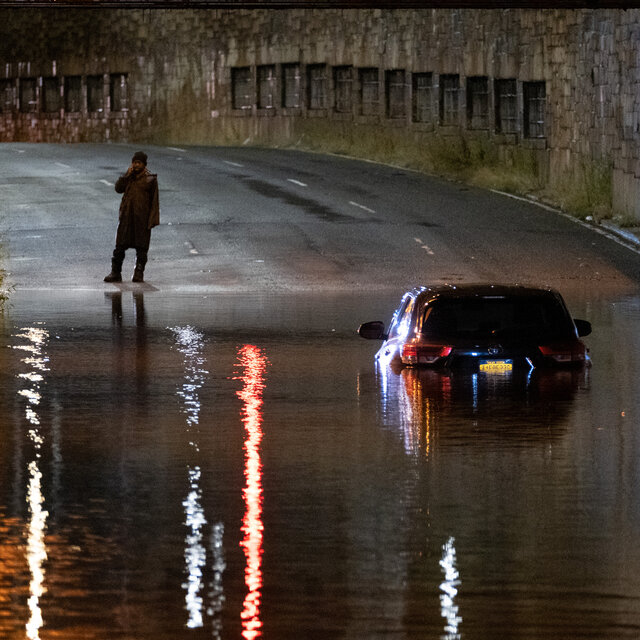
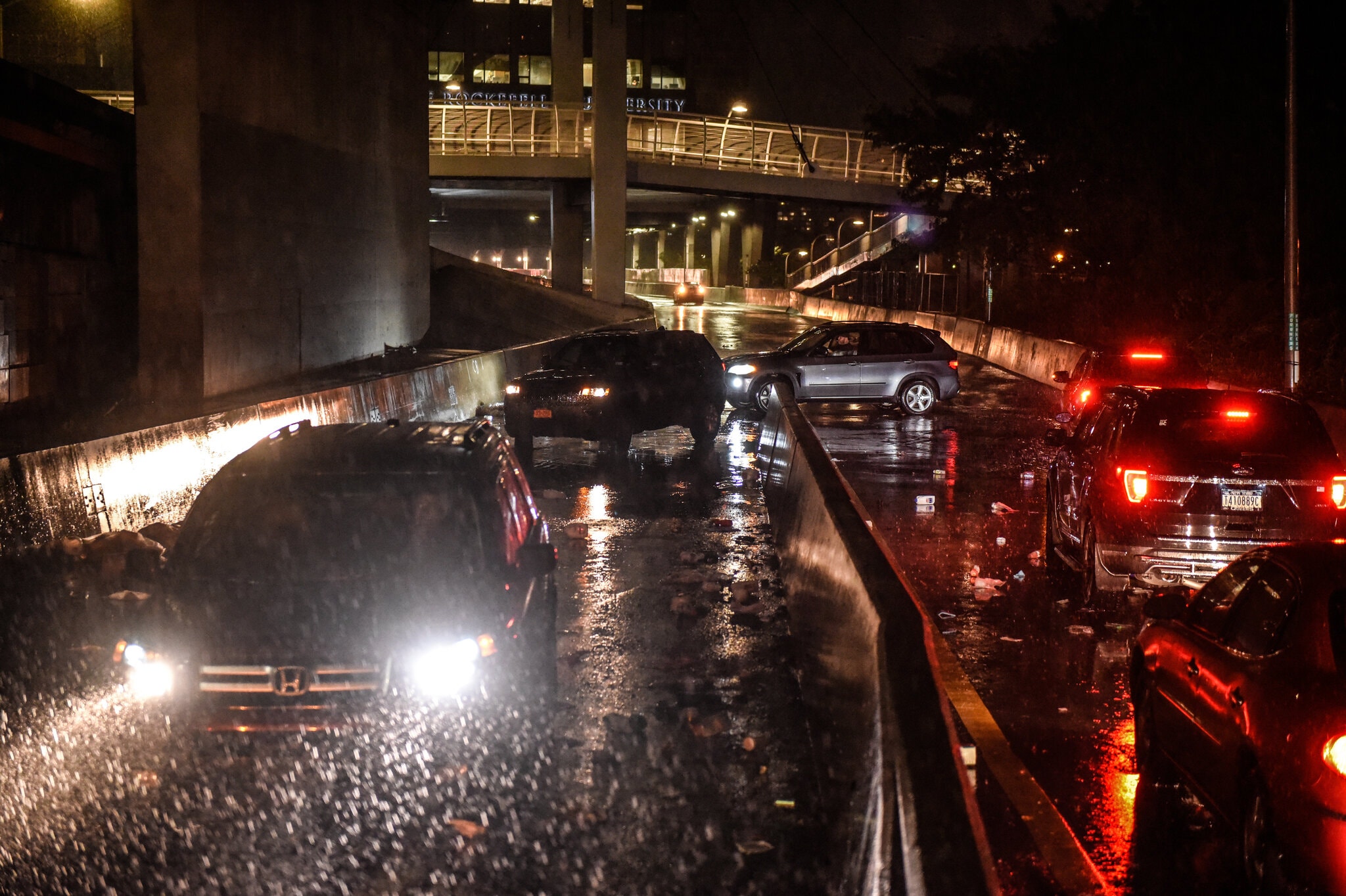
Just before 1 a.m., the city issued a travel ban in effect until 5 a.m. on Thursday. “All non-emergency vehicles must be off NYC streets and highways,” the emergency management office said on Twitter. A road through Central Park was dotted with cars that had been abandoned after getting stuck in the floodwaters.
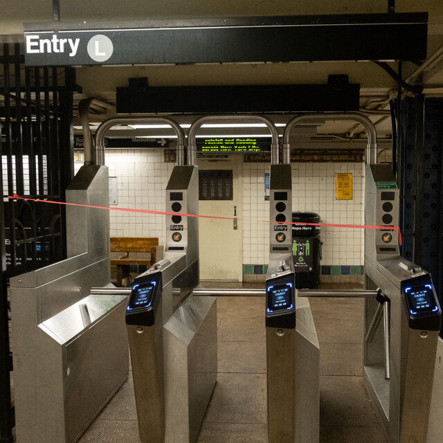
The Metropolitan Transportation Authority advised customers in an email alert late Wednesday: “Train service is extremely limited, if not even suspended, because of heavy rainfall and flooding across the region.” The system’s website showed service was suspended across more than 18 subway lines.
All New Jersey rail service, with the exception of the Atlantic City line, was suspended, New Jersey Transit said.
At Newark Liberty International Airport, 3.24 inches of rain were recorded between 8 and 9 p.m., the Weather Service said. Newark Airport was experiencing “severe flooding,” the airport said in a statement on Twitter, confirming videos posted on social media that showed deep water pooling inside.
“All flight activity is currently suspended & travelers are strongly advised to contact their airline for the latest flight & service resumption information,” the statement said. “Passengers are being diverted from ground-level flooded areas.”
In Passaic, at least one person was believed to have died after being trapped in a car in the rising floodwaters, Mayor Hector C. Lora said in an interview. The authorities were preparing to evacuate residents in part of the city, after the Passaic River breached its banks on Wednesday night and caused significant flooding downtown.
In Jamaica, Queens, one person died and another was taken to a hospital after firefighters responded to a report of flooding, the New York Fire Department said in a statement.
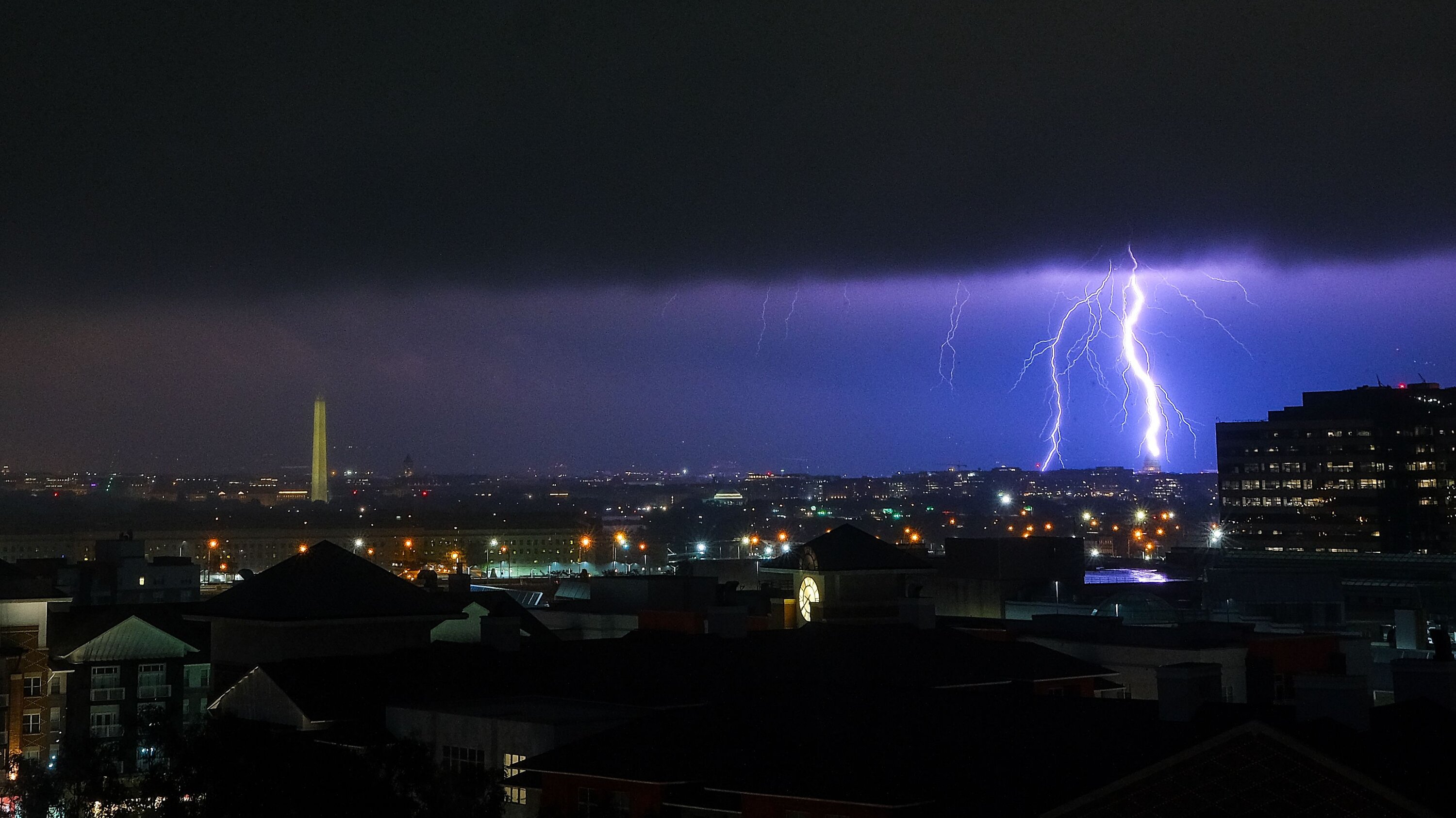
Around 9 p.m., the Weather Service issued a tornado warning for parts of the Bronx, after radar indicated a tornado had formed in the area.
The flash flood emergency issued by the National Weather Service was more severe than a flash flood watch or even a flash flood warning. The agency defines such emergencies as “exceedingly rare situations when extremely heavy rain is leading to a severe threat to human life and catastrophic damage,” typically with “life-threatening water rises resulting in water rescues/evacuations.”
At times, strong wind gusts blew the rain sideways, enough to delay a U.S. Open match at Louis Armstrong Stadium on Wednesday night, as rain made its way into the stadium in spite of its roof.
The storm system, advancing on a path to southern New England, brought drenching rain that could lead to life-threatening flooding, meteorologists said.
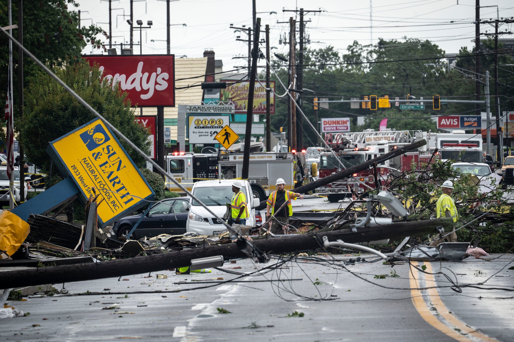
As the stormy weather moved northeast on Wednesday, it prompted a string of tornado warnings across parts of Pennsylvania, New Jersey and Delaware, including a warning for Philadelphia after the National Weather Service said a “large and extremely dangerous” tornado had been observed south of the city, near Mullica Hill, N.J.
“You are in a life-threatening situation,” the service said in a statement. “Flying debris may be deadly to those caught without shelter.”
Images and video circulating on social media on Wednesday showed homes that had been damaged as well as felled trees in the Harrison Township area in Gloucester County. The Harrison Township Police Department was not immediately available for comment on Wednesday night.
Wenonah, another small borough in Gloucester County, in southern New Jersey, was heavily flooded and “suffered extensive damage following this evening’s tornado event,” the mayor, John R. Dominy, wrote on Facebook. He urged residents to call 911 for emergencies and to stay home or in a safe place.
“Do not venture out. Many trees are unstable. Third, please do not approach downed wires as many may be live,” he wrote. “With nightfall, it is difficult to see and dangerous to either walk or drive. Many of our streets are impassable.”
He said the authorities were assessing the damage and added, “We do not have an estimate of when power will be restored.”
The storm had caused 57,519 power outages statewide and “these numbers are climbing,” Gov. Phil Murphy of New Jersey said on Twitter.
Residents in Lambertville, N.J., roughly 40 miles north of Philadelphia, posted photos that showed streets inundated with brown water, cars submerged up to their tires and flooded basements.
Other parts of New Jersey as well as Connecticut and New York, including New York City, were under a tornado watch until 1 a.m. Thursday, meaning conditions were favorable for tornado development. A few tornadoes were possible, as well as isolated wind gusts of up to 70 miles per hour, the Weather Service said on Twitter.
The storm, which hit Louisiana on Sunday as a Category 4 hurricane, has been downgraded to a post-tropical cyclone, according to the National Hurricane Center.
The last storm to hit the Northeast was Henri, which made landfall in southwestern Rhode Island on Aug. 22 as a tropical storm, sending lashing bands of rain across much of New England. Henri knocked out power in most of coastal Rhode Island, forced evacuations in Connecticut, stranded dozens of motorists in New Jersey and shattered rainfall records in New York City.
At its peak, Henri left more than 140,000 households without power from New Jersey to Maine, and in New York City, cars were left stranded in flooded streets. And Henri had followed Elsa, which in early July brought relentless rain and flash flooding to much of the Northeast, downed power lines and forced would-be subway riders to navigate waist-deep waters on their way into one Upper Manhattan station.
The morning commute on Thursday could be affected by drainage flooding in much of New England and the Mid-Atlantic, particularly in metropolitan areas, meteorologists said.
“Obviously, it’s been so wet,” Mr. Ramunni said.
“I can tell you it was the second-wettest summer on record for Central Park,” he said, adding that the amount of rain in the forecast, “on top of how wet it’s been, is going to cause issues.”
In light of the flash flood watch, New York City Emergency Management issued a travel advisory for Wednesday into Thursday morning.
At a news conference on Wednesday, Mr. de Blasio urged New York City residents to watch out for deceptively deep bodies of water that could appear to be shallow.
“We’ll get through this one, too,” Mr. de Blasio said. “Let’s get this storm by us.”
Gov. Kathy Hochul of New York ordered state agencies to prepare emergency response plans and told residents to exercise caution. Ms. Hochul also warned of the possibility of a tornado in the downstate area. More than 5,000 utility workers across the state have been prepared for damage and restoration responses, she said.
Reporting was contributed by Isabella Grullón Paz, Anne Barnard, Eduardo Medina, Matthew Haag, Azi Paybarah, Derrick Bryson Taylor and Ashley Wong.
— Jesus Jiménez and Michael Levenson

The remnants of Hurricane Ida tore through the New York City region on Wednesday night, dumping record rain and creating flooding in New Jersey and the five boroughs. Here’s a collection of photos of the storm.
About 200 people were rescued from a train near Newark Airport on Wednesday night as heavy rains and flooding from the remnants of Hurricane Ida shut down major train routes and other transit passageways throughout the New York region.
The passengers had been stuck in a train near the airport for about three and a half hours before they were rescued at about 9 p.m., Jim Smith, spokesman for New Jersey Transit, said. No injuries were reported, he said.
The storm flooded the region and poured water throughout New York City’s underground transit system, halting what is normally 24-hour service. Janno Lieber, acting chair and C.E.O. of the city’s Metropolitan Transportation Authority, said in a statement that “massive amounts of water” from an “epic storm” had created “severe disruptions.”
New Yorkers should not travel until further notice, he said.
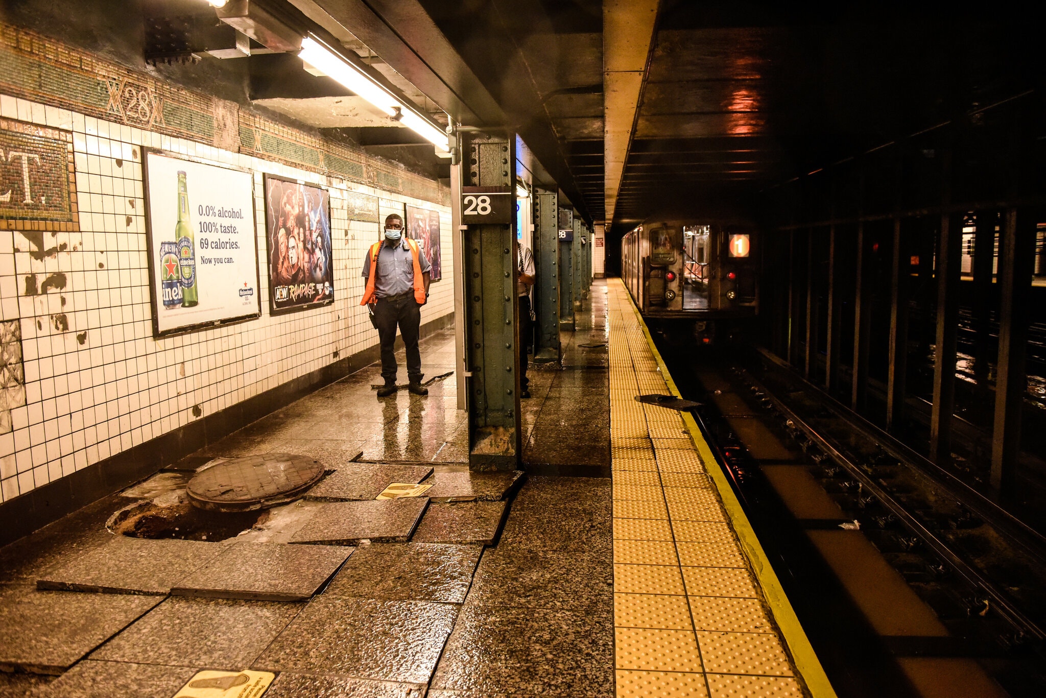
Second perspective on 28th St & 7 Ave subway station (Chelsea, Manhattan) pic.twitter.com/CYQvPkgeVg
— Christiaan Triebert (@trbrtc) September 2, 2021
Both Metro-North Railroad and the Long Island Railroad suspended service because of the storm.
New York City Transit officials offered stark advise to any riders attempting to travel Wednesday night. “If you’re on a train that’s stuck, stay on that train,” the transit system said on Twitter, calling it “the safest place to be” unless transit officials on scene advise otherwise.
Extreme storms have battered New York’s 24-hour train service in recent years. Service was stalled for several days following damage from Hurricane Sandy in 2012. And in 2015, officials shut down subway service in anticipation of a severe snowstorm, which turned out to be milder than expected.
At the 96th Street train station in Manhattan, Mario Villa, a cook at Tartina, had been waiting since just after 10 p.m. to get to his home in Queens. At midnight, sitting on a stalled No. 1 train beside a co-worker, he said, “We’ll wait. We don’t get upset. We just have to wait.”
Andy Newman, Anne Barnard, Stacy Cowley and Christiaan Triebert contributed reporting.

Before it dumped several inches of rain on New York City, the tenacious remnants of Hurricane Ida traveled through the Mid-Atlantic on Wednesday, spawning several tornadoes in Maryland and overtopping a dam in central Pennsylvania.
As the stormy weather moved northeast, it prompted a string of tornado warnings and watches across parts of Maryland, Pennsylvania, New Jersey and Delaware. The National Weather Service in Baltimore warned that high winds could cause damage to houses and mobile homes, and asked residents in the southeastern part of the state to take cover.
The National Weather Service later reported at least four tornadoes in Maryland and one near Mullica Hill, N.J.
Mitchelle Stephenson, a spokeswoman for Annapolis, said a tornado that landed near the city had left about 2,500 residents without power, and that the city had received reports of fallen trees. The fire and police departments had closed streets to assess the damage, according to Ms. Stephenson, who said no injuries had been reported.
Video on social media showed strong, fast winds and roadways obstructed by downed utility poles, signs and trees.
Forecasters were concerned about flooded rivers, and Wilmore Dam in central Pennsylvania was “overtopping” at one point with approximately three feet of rainwater, said John Banghoss, a meteorologist with the Weather Service in State College, Pa. About 42,000 residents were ordered to move to higher ground.
A flash flood emergency was issued for northeastern Chester County, northwestern Delaware County, and Montgomery County in southeastern Pennsylvania. The Weather Service said it had received reports of rainfall totals of 4.5 to 7 inches.
The storm will next move into New England, which was previously hit by Henri and Elsa this summer. Henri, which made landfall in southwestern Rhode Island on Aug. 22 as a tropical storm, sent lashing bands of rain across much of New England.
Ida is expected to do the same.
“It’s going to drop heavy rain before it leaves,” Dan Thompson, a meteorologist with the Weather Service, said.
Reporting was contributed by Isabella Grullón Paz, Eduardo Medina, Derrick Bryson Taylor and Ashley Wong.

As Louisiana endured its third day of widespread power losses after Hurricane Ida swept through the state, residents on Wednesday faced the compounding effects of the outages, including severe water and gas shortages.
Nearly one million customers in Louisiana were still without electricity because of Ida, which knocked out the transmission lines that power New Orleans. In many places in Jefferson Parish, access to drinking water required long waits in line. And nearly a third of the fuel stations in the state were out of gasoline or could not distribute it on Wednesday afternoon, said Patrick De Haan, the head of petroleum analysis at GasBuddy, an app that helps drivers find fuel.
“We are asking people to try to be patient and understanding,” Gov. John Bel Edwards said at a news conference. “Anytime you have a storm that is this devastating, it will take some time to get all of that infrastructure back and working.”
At least one Orleans Parish resident is presumed to have died from carbon monoxide poisoning, and two people died in Adger, Ala., while working to restore power, bringing the number of deaths linked to the storm and its aftermath to at least eight.
President Biden planned to visit Louisiana on Friday to see the damage firsthand, Senator Bill Cassidy said in a statement. A White House official confirmed the trip without offering details.
Entergy, Louisiana’s largest utility, announced in the morning that it had restored electricity to about 107,800 customers across the state but that it could be days longer before the cities hit hard by Ida had full power again.
“This is the first step in returning to normal,” Deanna Rodriguez, the chief executive of Entergy New Orleans, said at a news briefing.
Lights began turning back on in the French Quarter on Wednesday night, but many people remained in the dark. Early Thursday morning, Entergy said it expected customers in the Baton Rouge area to have power restored by Sept. 8.
Joshua D. Rhodes, a researcher at the Webber Energy Group at the University of Texas at Austin, said it was difficult to predict when power would be fully restored without a full accounting from Entergy on the damage to its system. He cautioned that it could take weeks, if not months, for everyone to get power back.
“Usually, there is a core that remains,” Mr. Rhodes said. “But this is a complete and total blackout.”
The electricity failures can shutter refineries as well as gas stations, Mr. De Haan said, creating a logjam at the precise time people relying on generators have increased demand for fuel.
Many people looking for gasoline or diesel on Wednesday were out of luck. Stations had largely run out of fuel, leaving long lines of cars — as well as people on foot, toting empty gas cans, in search of a working pump — snaking through the streets.
Collin Serigne, a photographer from Lafourche Parish, said people in and around his town of Golden Meadow were struggling with a severe lack of food and water, which was only compounded by the lack of fuel.
After delivering supplies to friends and family members, Mr. Serigne, 20, needed more gas — but the only functioning fuel station nearby had a six-hour line. So he and a friend drove for more than two hours over debris-strewn roads to reach New Iberia, where the line was short, and stocked up on extra fuel to deliver to people in his town who needed it.
“We saw some people fighting in a gas station,” Mr. Serigne said. “Everybody’s fueling up their extra gas tanks.”
The governor said he had already had three conversations with the White House about the state’s fuel issues.
“The state of Louisiana provides fuel for the rest of the country,” Mr. Edwards said. “And now we need the rest of the country to give back a little fuel back to Louisiana.”
At a news briefing, Cynthia Lee Sheng, the Jefferson Parish president, reiterated that the parish was “a broken community” that did not have electricity, communication or gas. She said she had taken an aerial tour over parts of the state on Wednesday and had been stunned by the widespread damage in Grand Isle and Lafitte.
“I had no idea how devastating the storm was to such an incredible amount of communities,” she said. “It looks like matchsticks, like a little pile of matchsticks.”
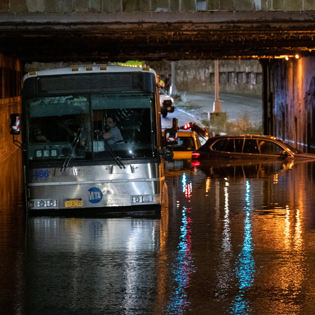
City buses turned into amphibious vehicles, plowing through several feet of water, past orange traffic cones floating like buoys in the muck.
Subway stations roared with the sounds of rushing water that cascaded through platforms and down the stairs as if from a churning waterfall, flooding the tracks below.
In parts of Brooklyn, cars moved through lakes of mud-brown water, their headlights shining on waves that formed in front of their wheels and lapped at the feet of brownstones.
The sudden inundation from the remnants of Ida transformed familiar scenes of life in New York into otherworldly and waterlogged chaos on Wednesday night. The rain continued into early Thursday morning.
It was frightening and foreboding — a vision, many said, of the future as climate change produces more extreme and heavy rainfall during storms.
Nearly every subway line in the city was shut down, and Mayor Bill de Blasio declared a state of emergency, citing the “record-breaking rain across the city, brutal flooding and dangerous conditions on our roads.”
“If you’re thinking of going outside, don’t,” he said on Twitter. “Stay off the subways. Stay off the roads. Don’t drive into these heavy waters.”
The National Weather Service placed New York City under a flash flood emergency for the first time after the city was socked with torrential rainfall.
Over a single hour — between 8:51 and 9:51 p.m. — Central Park recorded 3.15 inches of rain, smashing a record set only last week, when 1.94 inches of rain fell in the park during Tropical Storm Henri.
Not everyone was heeding the official warnings to stay inside.
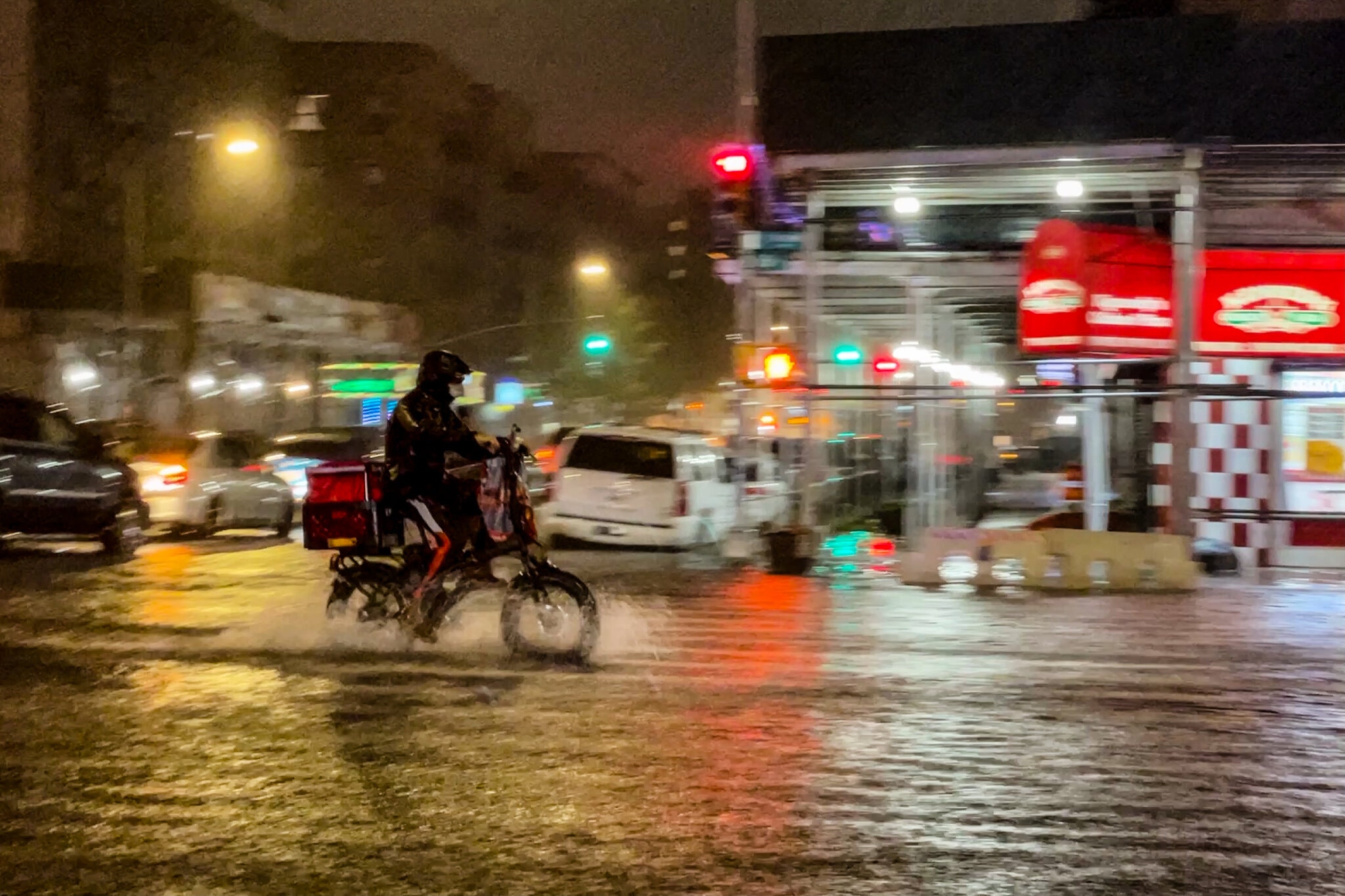
Social media filled with images of delivery workers driving or pushing bicycles through the floodwaters. One video posted on Twitter showed a man floating on an inflatable raft in a flooded alleyway, casually puffing on a hookah. Other videos showed cars trapped on flooded boulevards.
“We are seeing way too many reports of water rescues and stranded motorists,” the New York office of the National Weather Service said on Twitter. “Do not drive through flooded roadways. You do not know how deep the water is and it is too dangerous.”
All across the city, wild scenes were unfolding.
City officials warned that 60-mile-an-hour wind gusts were expected. And the wind-driven rain poured through the roof of Louis Armstrong Stadium, pelting fans who opened umbrellas and delaying a match at the U.S. Open in Queens.
The Film Forum, an art-house cinema in Manhattan, flooded during a showing of the French film “La Piscine”, leading audience members to joke that it was an immersive experience.
On Broadway, theatergoers watching “Pass Over” eyed one another warily as some half-dozen screeching emergency alerts rippled through audience members’ phones — though the actors stayed in character.
The stunning storm was deadly serious, with unpredictable risks unfolding as the sluicing rain and gusting wind continued in the dark, taking some motorists and walkers by surprise. Residents in some neighborhoods posted videos of water rushing in through closed doors, filling hallways.
“We are BEYOND not ready for climate change,” Mark Levine, a City Council representative, declared on Twitter.
Jesus Jiménez and Maggie Astor contributed reporting.
— Michael Levenson and Anne Barnard
The last time Peggy Gamberella, 63, heard from her younger sister, she said she had no drinking water or electricity and had lost everything in Hurricane Ida.
The sister, Patricia Killingsworth of Chauvin, La., has a chronic lung disease and has trouble breathing when it’s hot. She relies on a machine to help her breathe, but that device needs to be plugged in. After Ida knocked out her power, Ms. Killingsworth was able to use someone’s generator, her family said.
“I don’t see no help in sight for days,” Mr. Killingsworth, 61, wrote in a text message before pleading, “Send help if you can.”
That was on Monday evening; the family hasn’t heard from her since.
Ms. Gamberella said the family had been scrambling for two days to find help, but she lives more than 200 miles away, in Laurel, Miss.
“I just pray she is OK,” Ms. Gamberella said.
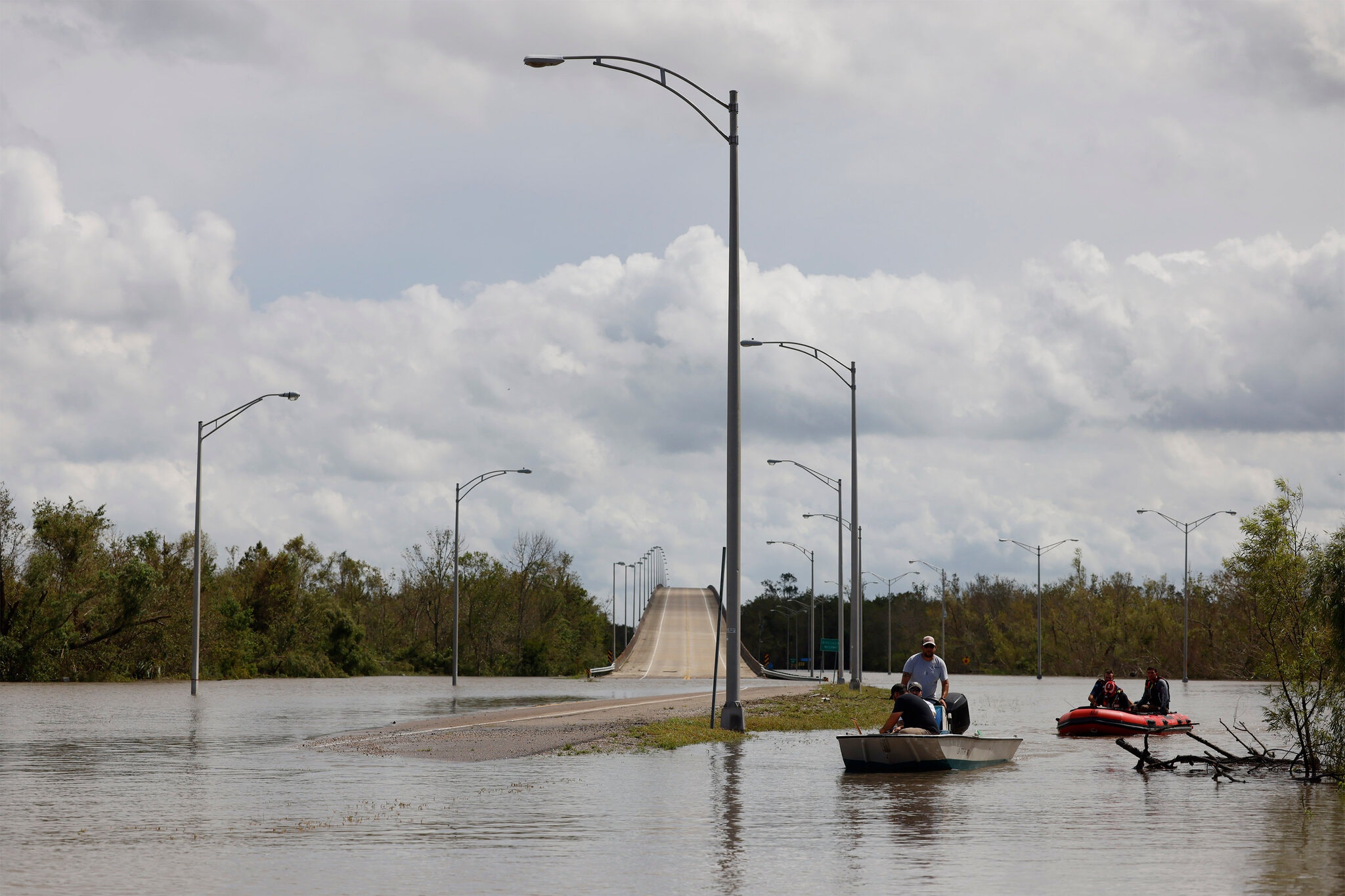
Roads are still blocked in some southern Louisiana communities throughout Terrebonne Parish because of downed trees and power lines, making access and rescue efforts difficult, according to Lauren Smith, volunteer coordinator and spokeswoman for the Cajun Navy Ground Force, a community-led disaster-response organization.
She said that while response teams work to clear the roads, finding fuel to power generators, chain saws, equipment and vehicles is one of the biggest challenges.
Having fuel for generators is especially critical for people with disabilities and medical issues, she said, citing a woman in need of hospice-level care whose generator went out on Monday.
“We had to basically take all the fuel that was running generators for our camp and take it over and fill up her generator,” she said.
In general, communities throughout the Gulf Coast region are more likely to rely on backup generators than solar power, which can lead to problems if there are fuel shortages, according to Andrew Schroeder, vice president for research and analysis at Direct Relief, a nonprofit humanitarian organization.
“Every day that goes by becomes an increasing challenge,” he said. “The first 24 hours, you have maybe not too many problems. By the time you’re into a week, and we’ve seen this with a lot of other places, then you have problems with dialysis, and you have problems with oxygen generation and ventilation.”
According to Department of Health and Human Services data, there are thousands of Medicare beneficiaries who rely on electricity-dependent medical devices living in Orleans, Jefferson, Terrebonne Parishes and other places currently without power.
In Lacombe, La., Megan Alfonso, 33, has been sheltering in place with her mother, Deborah Alfonso, since Saturday.
Her mother, 63, who has chronic lung disease, usually relies on an oxygen concentrator machine that needs to be plugged in. But after the power went out on Sunday afternoon, she switched to using oxygen tanks.
The family started out with five tanks; each one has enough air to last for about two and a half hours. By Tuesday morning, they were on their last tank.
“She’s more scared then anything,” Ms. Alfonso said of her mother. “She started not using them and just risking it so she can save them.”
After waiting for a response from emergency officials or response groups for hours, Ms. Alfonso decided to take a risk. On Tuesday evening, she drove to a medical supply office roughly 30 minutes away, even though she said the vehicle sounded “rough” after being submerged in water hours earlier.
She got four full tanks of oxygen — enough for 10 more hours.
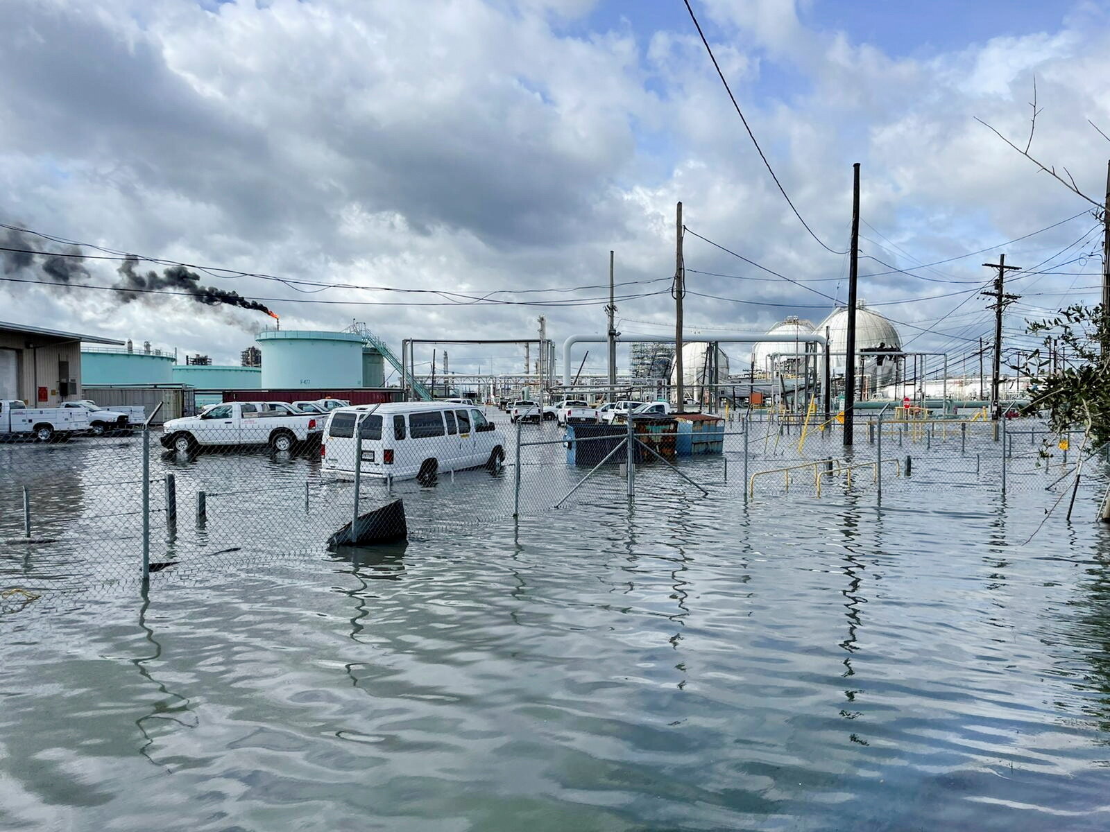
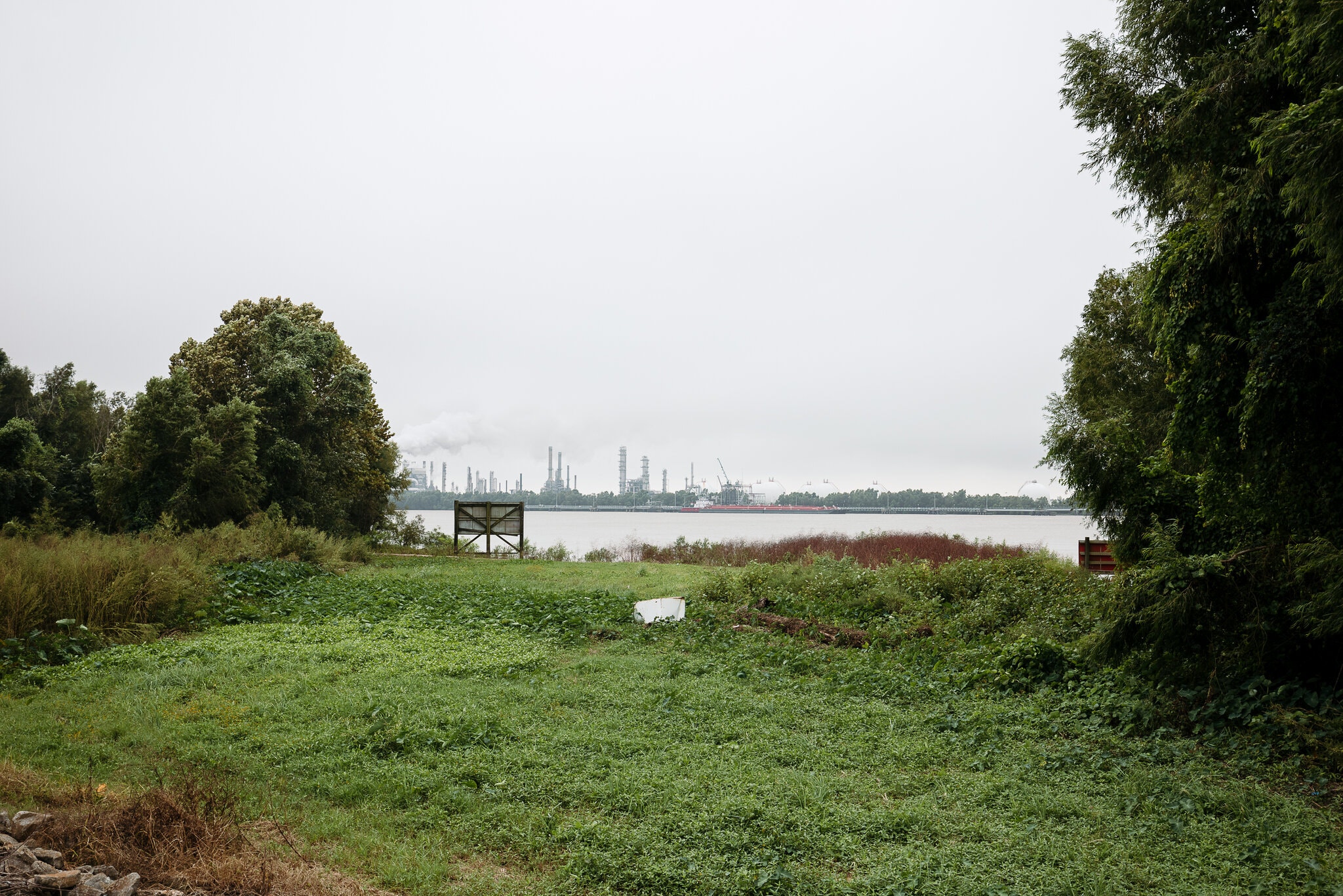
Early incident reports filed with the federal authorities are starting to paint a clearer picture of the damage wrought by the hurricane to Louisiana’s industrial corridor, complicating relief efforts and adding to the conditions that make it perilous for residents to return.
An analysis of facility records and power outage data shows that at least 138 industrial sites that handle large amounts of hazardous substances are in and around parishes that have completely lost power, forcing facilities to rely on precarious backup power systems. Hurricane Harvey, which brought torrential rain to parts of Texas in 2017, knocked out cooling power at a chemical plant outside Houston, triggering a series of explosions that injured emergency workers and prompted a local evacuation.
Local officials were still assessing the full extent of the damage. But adding to the uncertainty, the Louisiana Department of Environmental Quality warned that more than a third of its ambient monitoring sites had stopped working, primarily because of power outages. And some sites, like the Valero Refinery in St. Bernard Parish, said they had shut down their air monitors ahead of the storm to protect the equipment.
“Survival and recovery is what’s most important right now,” said Yudith Nieto, a longtime community organizer working in both Louisiana and Texas. But as residents start to return to their homes and size up the damage, “facilities and the chemical runoff for emissions and pollution will be a big concern.”
At the fertilizer facility in Ascension Parish run by CF Industries, the country’s largest producer of fertilizer, crews were unable to reach two storage tanks that were releasing anhydrous ammonia, the company said in a report to the federal National Response Center. Anhydrous ammonia is a colorless, pungent gas that can cause severe health problems, including respiratory damage and blindness. Hurricane winds temporarily extinguished the flares that had been burning the chemical off, the company said.
Christopher Close, a spokesman for CF Industries, said there was no indication the gas leaked outside the facility. “Any significant release would likely be noticed and reported in the surrounding area (by smell),” Mr. Close wrote in an email. Company engineers were going through data to determine the extent of the ammonia released, he added.
Phillips 66 reported two damaged pipelines in St. Charles Parish were leaking propylene and isobutane, both flammable gases that are highly hazardous to human health. Local employees did not know whether any chemicals had also reached nearby waterways, the oil and gas company said in its filing. Bernardo Fallas, a spokesman for Phillips 66, said the pipelines had been shut down before the storm made landfall, and any chemicals that remained were being flared. The company would assess the damage and start repairs once its workers were able to safely reach the site, he said.
Power outages caused by the storm triggered a release of ethylene dichloride from a storage tank at a plastics plant in Plaquemine operated by Shintech, a subsidiary of the Japanese industrial giant Shin-Etsu. The chemical, used to produce PVC plastic, can harm the respiratory system and has been linked to other negative health effects. The facility is undergoing a $1.5 billion expansion, part of the continued expansion of Louisiana’s fossil fuel infrastructure. Messages left with Shin-Etsu went unanswered.
Shell has assured the Environmental Protection Agency that a small amount of gases were still going to the flares, the agency said in its latest bulletin. The Louisiana State Police is also monitoring a gasoline spill at the site, the E.P.A. said.
Environmental groups have heightened calls for an overhaul of safety rules that are meant to protect the public from chemical leaks and accidents, saying companies should be required to more explicitly prepare for climate-related disasters like floods, wildfires and other climate impacts that threaten communities near chemical facilities. Unions representing plant workers and emergency responders, who risk some of the worst chemical exposures, also say stronger protections are needed.
“These communities already have the stress of being near these facilities on a day-to-day basis,” said Casey Kalman, a researcher at the Union of Concerned Scientists, who carried out the analysis of the industrial facilities without power.
“But every time a storm hits, the dice is being rolled and there’s the potential that there could be some kind of release or explosion that could harm them and their families,” she said. “They have to worry about a double disaster.”
Sites aren’t currently required to have backup power, and emergency responders often aren’t given sufficient information on chemicals at the site to fight leaks and fires. Environmental groups are also calling for air monitoring along fences surrounding facilities, and alerts issued in multiple languages, to keep nearby neighborhoods informed of any threats to safety.
Those neighborhoods tend to be disproportionately low-income and communities of color. Black, Latino and other people of color account for nearly half of those who live within one mile of hazardous industrial sites regulated by the E.P.A., agency data shows.
The Obama administration had moved to strengthen emergency preparedness at those sites, which are required to submit Risk Management Plans to the E.P.A. But President Donald J. Trump proposed weakening the regulation instead.
President Biden is now in the process of reviewing the rules, which would apply to more than 12,000 industrial facilities in the United States, such as chemical manufacturers, oil refineries, water treatment plants, fertilizer plants, and pulp and paper mills. More than 2,500 chemical facilities in the United States already lie in areas prone to flooding.
The flooding and widespread power failures were also hampering efforts by the E.P.A. to survey damage to 23 Superfund toxic cleanup sites in Louisiana. As of Tuesday, agency staff said they had assessed 10 and had found no chemical releases or other problems. As many as 60 percent of these sites are exposed to flooding, storm surge, wildfire, and sea level rise, a Congressional audit found in 2019.
Wilma Subra, a Louisiana chemist who has helped communities battle industrial pollution, said the combination of widespread power outages and leaks was particularly worrying.
“When a lot of the community doesn’t have access to electricity or internet, they can’t receive these alerts,” she said. “It could be happening in their backyard or their side yard and they have no way of knowing.”
The effects of Hurricane Ida will be felt far from where it made landfall in southern Louisiana on Sunday. As it moves across the Upper Ohio Valley and toward the Northeast later in the week, it is likely to cause heavy downpours, including up to 10 inches of rain in some parts of the Mid-Atlantic. More than 80 million Americans were under a flood watch or advisory, with the majority associated with Ida’s heavy rains.
Although scientists are not yet certain about how climate change affects every characteristic of tropical cyclones, there is broad consensus that a warming climate will bring more extreme and heavy rainfall during storms. Warming increases the amount of water vapor in the atmosphere, which in turn can produce more rain.
“We tend to think that once tropical storms move over land they run out of fuel,” said Rosimar Ríos-Barríos, a research meteorologist at the National Center for Atmospheric Research. But the winds in a tropical storm can extend thousands of miles from its center. In this case, even as Ida moves inland, Dr. Ríos-Barríos said, it will continue to draw in very warm, wet air from over the Gulf of Mexico and wrap it around its cyclone. That air can contribute to worsening rainfall.
“We are seeing this increase in extreme rainfall for all types of events,” said Suzana Camargo, a climate scientist at the Lamont-Doherty Earth Observatory at Columbia University. “With hurricanes, we would expect more intense rainfall. That’s what happened with Ida.”
The amount of rainfall associated with a tropical cyclone has to do with how hard it rains and for how long, which itself depends on a cyclone’s speed. Rainfall from Hurricane Harvey, the wettest tropical cyclone on record, dropped more than 60 inches in eastern Texas in 2017. The heavy rain, and subsequent flooding, was caused in part by the hurricane stalling near the coastline.
Ida was continuing to move at around 10 to 15 miles an hour, “an expected pace,” said Dr. Ríos-Barríos. The primary weather system in the United States moves in a general V-shaped pattern. Winds from the Western United States move south toward the Gulf of Mexico, then turn toward the northern Atlantic. But other weather systems can bring currents in opposing directions, changing the direction of a storm or altering its speed.
As a tropical cyclone moves farther inland, its path is driven by a contrast in temperature. Dr. Ríos-Barríos said that may be one reason central Pennsylvania and West Virginia are expected to see such extreme rainfall, up to 10 inches in some places. There, the cyclone may develop a warm front, which will lift the air, create clouds, and produce more rainfall.
Many of these areas in the storm's path have already received exceptional rain this summer, leaving some rivers higher and soils more saturated, worsening the risk of flooding. The Middle Tennessee Valley, which experienced flash flooding earlier this month that killed at least 20 people, may see up to four inches of rain on Tuesday and Wednesday.
Whether climate change made Ida and the scope of its flooding more likely, and if so, by how much, won’t be known until scientists can perform an attribution study, a type of research that quantifies the links between climate change and specific extreme weather events.
But scientists agree that Ida is a harbinger of future hurricanes. “If our planet continues to warm at the alarming pace that it is warming, then Ida is an example of what we might expect to see in the future,” said Dr. Ríos-Barríos. “That’s very scary.”