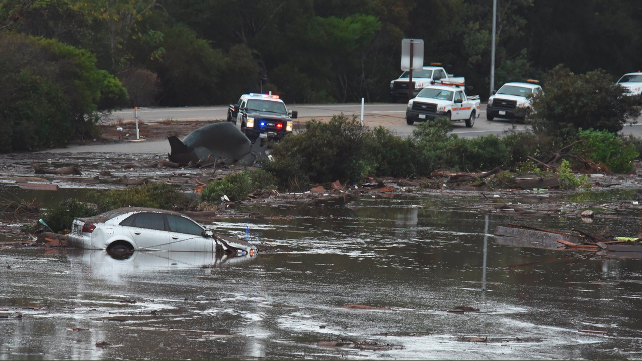
The ongoing record breaking rainfall in California, which started on Saturday, raises the danger of a potential megaflood.
While California suffers many devastating natural disasters, such as earthquakes, as well as wildfires and droughts—which have repeatedly broken records in recent years under the influence of man-made climate change—among the worst natural disasters to hit the western United States in the last 160 years was the Great Flood of 1862.

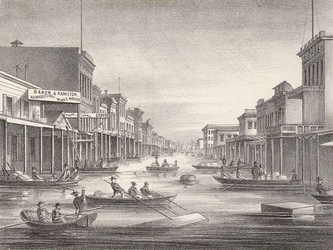
Set off by a series of storms that inundated much of the land from Oregon to San Diego, the agriculturally rich Central Valley became a vast inland sea, 300 miles long and 20 miles wide. The state capital in Sacramento was under water for six months, forcing the government to relocate to San Francisco. One-third of California’s state property was destroyed, along with one in every eight private homes.
Thousands of people died, possibly up to 1 percent of California’s entire population. And while floods of this magnitude used to happen every 200 years or so, models generated by Daniel Swain and researchers at UCLA’s Department of Atmospheric and Oceanic Sciences found that they will now happen roughly every 65 years, due to the effects of climate change. Swain also predicts a 20 percent increase in the intensity of megastorms, meaning the next one could be far more devastating.
Worryingly, the period leading up to the Great Flood of 1862 was similar to today. The state was emerging from two decades of severe drought. Farmers and ranchers had been praying for a wet winter. At first, it looked like they would get what they wanted. The storms began in November, 1861, with weeks of snow at high elevations.
But then it started to rain. In California, it rained for 43 straight days, starting on Christmas Eve. Entire communities were swept away. Transportation, mail and communication across the state were disrupted for a month. California’s new governor, Leland Stanford, had to take a rowboat to get to his inauguration. In Nevada, the Carson Valley became a lake. In Idaho, the Boise River swelled to two miles wide, washing away portions of the Oregon Trail. The Colorado and Gila Rivers flooded in New Mexico Territory, turning Fort Yuma into an island.

The flood also impacted the course of California’s economy. Prior to the storm, it had been dominated by cattle ranching in the Central Valley, run predominantly by Mexicans who had gained citizenship and land rights at the end of the Mexican-American War (1846–1848) under the Treaty of Guadalupe Hidalgo. Those who survived the 20-year drought, saw their lands flooded and cattle drowned by the storms. One quarter of the state’s 800,000 head of cattle perished in the flood. The ranchers had to sell their land to Anglo settlers at pennies per acre. And the Anglo farmers began growing nuts, cotton and vegetables. Meanwhile, many of the Mexican ranchers were forced to become day laborers just to survive.
The event also influenced the course of wars. In New Mexico Territory, for example, the flooded Rio Grande impeded the California Column as it attempted to cut off the retreating Confederate Army of New Mexico, allowing them to escape into Texas. And in California’s Owens Valley, it brought the Paiutes, who were on the brink of starvation because the storms had decimated the wild game they relied on, into conflict with ranchers, who were trespassing on their lands to graze their herds. Over 200 Native Americans died in the Owens Valley Indian War (1862-1867), along with roughly 60 members of the California Militia.
Research indicates that storms of this magnitude have occurred roughly every 200 years in California, which means another is likely, possibly soon. The United States Geological Survey (USGS) examined sediment data from the San Francisco Bay Area, Santa Barbara basin, Sacramento Valley, and Klamath Mountain region, and found megafloods occurred in the years 212, 440, 603, 1029, c.1300, 1418, 1605, 1750, 1810, as well as 1861–62. Many were worse than the flood of 1862, especially the one in 1605, which researchers believe was 50 percent worse than any of the others.
The storms that caused these megafloods were the result of atmospheric rivers, thin belts of water vapor that hover about a mile above the Earth’s surface, extending thousands of miles over the sea. They originate in the tropics and carry as much water as 10 Mississippi Rivers. Weaker atmospheric rivers hit the California coast yearly, producing 30–50 percent of the state’s rain and snow in just 10 days each year.
Even these “minor” atmospheric river events are significant. They cause more than 80 percent of the flooding in California’s rivers and 80 percent of the levee breaks that occur in the Central Valley. Another atmospheric river hit Northern California on Sunday, October 24, with a predicted three inches of rain in a single day and some areas seeing significantly more. The National Oceanic and Atmospheric Administration (NOAA) has declared a La Niña for the second winter in a row. Because La Niñas often bring increased rain to Northern California, this coming atmospheric river could be the beginning of a very wet winter.
According to climate models, global warming will increase the number of atmospheric rivers hitting California each year and they will carry more water than previous ones, increasing the intensity of megastorms. Some models predict that the odds of another megastorm like 1862 will at least double by 2100 due to the extra moisture caused by global warming. Swain says that if greenhouse gas emissions continue to increase at today’s rate, the US could see a 30 to 127 percent increase in the number of people at risk from floods nationwide.
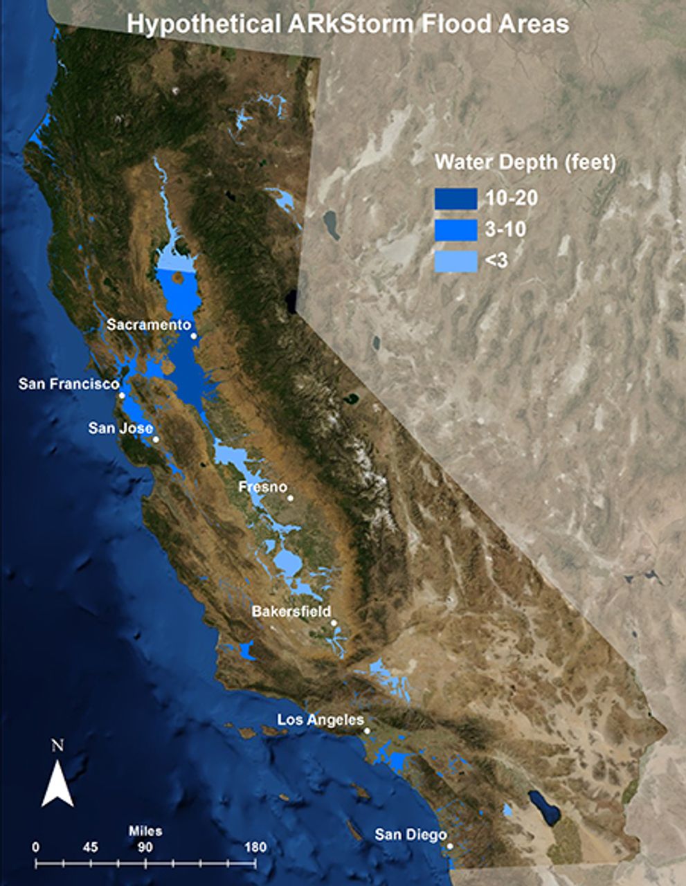
Even without the effects of climate change, the consequences of a megaflood today will be much more serious than they were in 1862, when California had only 500,000 residents. Today there are hundreds of communities and large cities in the Central Valley, with a combined population of 6.5 million people. The Sacramento area alone is home to more than 1 million people, while Fresno has over 500,000 people, and Bakersfield has nearly 400,000 residents. The Central Valley includes the flood plains of two major rivers, the Sacramento and the San Joaquin, as well as many smaller rivers that drain down from the Sierra Nevada mountains.
This is not just a problem for Californians, either. Another flood like the one in 1862 would have a dire impact on the availability and cost of food for everyone in the US. The Central Valley comprises less than 1 percent of all US farmland, yet it produces 25 percent of the nation’s food supply, including 90 percent of the broccoli, carrots, garlic, celery, grapes, tangerines and plums, as well as 40 percent of the lettuce, cabbage, oranges, peaches and peppers, and over 20 percent of the milk. That is $46 billion worth of food annually, double the next most agriculturally productive state in the US.
A megaflood would also be an ecological nightmare. There are 4 million cows in the state and a massive flood would severely pollute the soil and groundwater with rotting carcasses and concentrated manure from drowned cattle. The hundreds of millions of pounds of fertilizers and pesticides used in the state each year would be similarly thoroughly mixed into California’s broader ecology.
Oil spills are a further danger. Kern County, for example, is one of the nation’s most prolific oil-producing regions, generating 70 percent of California’s oil and more than double what the state of Louisiana produces. It also has two large refineries. A major flood would pull much of these toxins into the soil and ground water and quickly spread them throughout the flooded regions, potentially creating by far the biggest cleanup site in the nation’s history.
In 2005, in the wake of the devastation wrought by Hurricane Katrina in New Orleans, the US Army Corps of Engineers inspected California’s flood control infrastructure and found that many of its levees were built between 1850 and 1920, with outdated engineering criteria and only sporadic improvements since then. Sacramento, which is situated at the confluence of two major rivers, the Sacramento and the American, had levees designed for an 80-year flood. It was the most at-risk metropolitan area in the country at the time, with less than half the flood protection of New Orleans.
In 2009, the Multi Hazards Demonstration Project (MHDP) of the USGS examined California’s historical record for flooding, as well as its flood control infrastructure. From that data, they made a prediction of the likely effects of a 1-in-1,000-year storm event called ARkStorm (Atmospheric River 1,000 Storm). They found that an atmospheric river lasting just 23 days would cause more than $725 billion in damage to property, business and agriculture, three times the damage from a hypothetical super earthquake (i.e., the Big One). It would affect up to 25 percent of all California homes and disrupt power, water and sewage for months; 1.5 million people would have to evacuate. And it would likely lead to food shortages.
The California and federal governments have largely ignored these reports. The state has spent only $2 billion on Central Valley flood control improvements since 2007, much of it on refortifying hundreds of miles of substandard levees. In 2018, Californians passed Proposition 68, which allocated $4 billion for parks and water projects. While the majority of the funding went to parks and recreational projects, just $550 million was allocated for flood protection. Proposition 3, which would have allocated another $700 million to Central Valley flood protection and $300 million to dam renovations, was rejected by voters in 2018. Nevertheless, as a result of the investments that have gone toward flood protection, Sacramento is now a Class 2 FEMA community (2nd highest level of premium reductions by flood insurance companies). And Roseville, also in the Central Valley, is the first and only Class 1 FEMA community in the US.

The reality is, however, that California still needs an additional $80 billion in investment and three decade’s worth of work to bring the rest of the state up to today’s flood safety standards. A 2017 analysis found that 50 percent of the urban levees in the Central Valley were not up to current engineering standards. And most of the rural communities in the Central Valley still had not received any funding to shore up their flood protections. The state’s dams are also in deplorable condition and are on average 70 years old.
The ARkStorm report warned that spillways could fail in a megastorm. A harbinger of this came during the 2017 AR event, when the Oroville Dam’s spillway failed and 188,000 people had to be evacuated, some on only a few minutes notice. That year was Northern California’s wettest winter in 100 years and the flooding resulted in $1.5 billion in damage. Yet, it was still a “mild” winter compared with 1862.
There are 26 dams in California with extremely high downstream risk, meaning hundreds of thousands, or millions, of people could be affected by a failure of any one of them. History has shown the consequences of not shoring up dams for severe storm events and maintaining them to modern engineering standards. In 1975, Typhoon Nina produced so much rain that the Banquio and Shimantan Dams failed, killing 240,000 people in China and making 11 million homeless. A similar event in India killed 5,000 people in 1979. And in 1928, the St. Francis Dam, just 40 miles north of downtown Los Angeles, failed because of engineering flaws, killing at least 431 people. (In 1928, the population of Los Angeles County was only 10-20 percent of what it is today).
Though flood experts have known for decades about the threat of another megaflood, many regional flood managers, particularly in Los Angeles and Orange Counties, have argued that resources would be better spent on educating the public about the risks of living in a floodplain than on shoring up the state’s outdated dams and levees.
Many people who live in flood plains, however, cannot afford to move or put their homes on stilts. Many are living there precisely because of the skyrocketing rents and mortgages in the less flood-prone areas of San Francisco, San Jose, San Diego or Los Angeles, or because their jobs are there. And even if these workers did have the economic means to leave the area, such measures do nothing to protect against the catastrophic agricultural and ecological consequences of a megaflood.
Southern California is particularly at risk. During the 1862 flood, the Santa Ana, Los Angeles and San Gabriel rivers merged, creating an inland sea in Los Angeles and Orange Counties. In his book, Ecology of Fear, Mike Davis explains that residents were able to row from where the Los Angeles Civic Center is today to Newport Beach. Like the Central Valley, Los Angeles and Orange Counties were sparsely populated then. Now there are millions of people living in the floodplains of those two counties.
For a moment in history, it looked like development might not go the way it did. According to Davis, there were several developers, like the Olmsted Brothers, who, in the 1920s and 1930s, wanted to turn the Los Angeles River and adjacent plains into a green beltway, specifically for flood control and public recreation. They even called for the parklands to extend into low-income neighborhoods to benefit working class families. They envisioned retaining the broad natural channels of the alluvial plain as a nature preserve and as a sponge for the next flood. Instead, Southern Pacific Railroad, which owned much of the land, began the process of developing the area into a private subdivision, to the cheers of the Los Angeles Times and large speculators.
The flood of 1938 put a temporary damper on this speculative exuberance. Southern California got a year’s worth of rain in about two days, likely from an atmospheric river. Again, the Los Angeles, San Gabriel and Santa Ana Rivers merged, creating another inland sea. Up to 115 people died in that flood, while 5,600 homes were destroyed. In response, the US Army Corps of Engineers and other agencies began converting the Los Angeles River into a paved channel that would flush future storms out to sea. Reassured, the speculators returned and the housing boom resumed.
The channel is, however, only designed for a relatively small 50-year flood. A 100-year storm would likely flood 1,000 acres of adjacent lands, up to 18 feet deep in some places, affecting 3,300 parcels of land, including parts of Griffith Park, Glendale and Burbank. An ARkStorm would be far worse.
Like with the COVID-19 pandemic, scientists have known for decades about the risks of the next megaflood and government agencies have had ample opportunities to prepare. And as with the pandemic, there was very little done to prepare for such eventuality. It is up to the social force that will be most impacted by such devastating events, the working class, to fight for the resources and measures needed to avert such disasters and save lives.