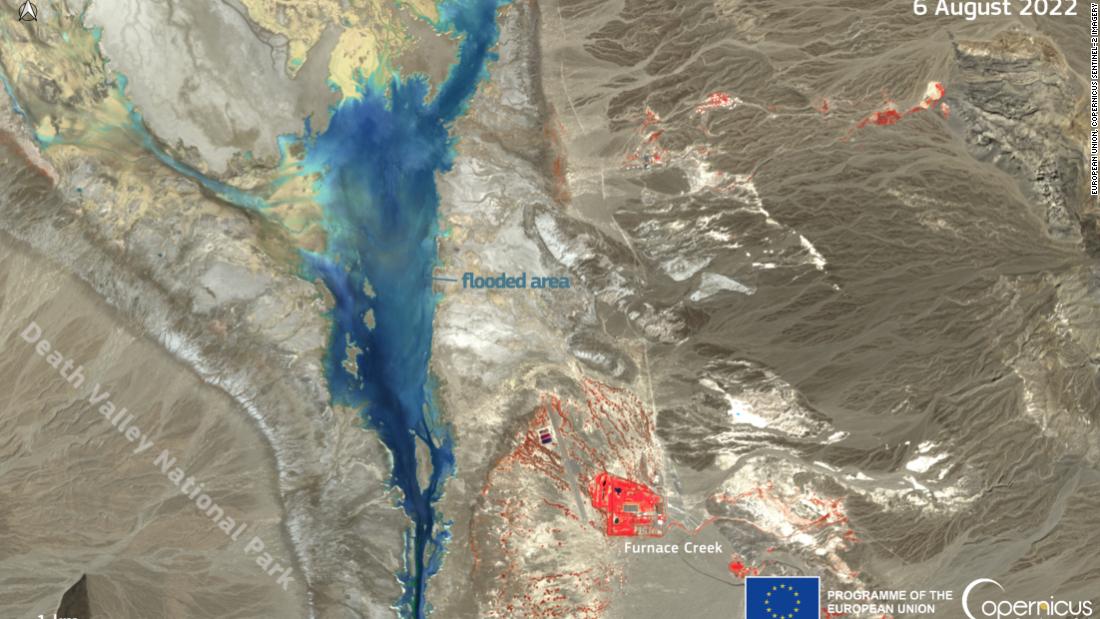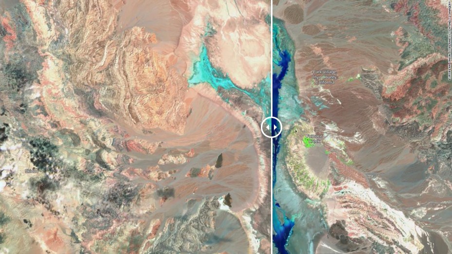
In less than two months we have seen at least four historic flood events occur across the country. Yellowstone flooded in mid-June, followed by the torrential flooding in St. Louis, then Kentucky, and just this weekend we had major flooding in Death Valley.
"On 5 August 2022, a flash flood hit the Death Valley National Park in California, USA. The amount of rain that fell in a few hours (34.5 mm or about 1.36 in) represented 75% of the volume that the area typically receives in a year, making 5 August the second-wettest day since the records started in 1911," according to Copernicus, a European Earth observation program.
This resulted in numerous landslides, burying cars and cutting off roads -- trapping roughly a thousand people inside the park.

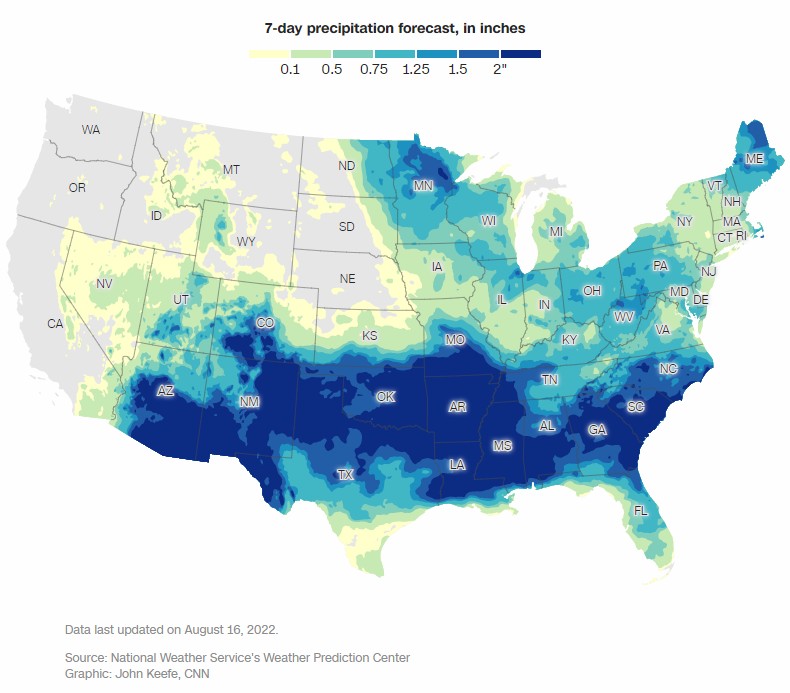
The last thing people want to hear this week is that more flooding is possible yet again for the Southwest and portions of eastern Kentucky. But the messaging is clear.
"Heavy rainfall rates will be possible," said the National Weather Service office in Jackson, Kentucky, adding, "Isolated to scattered instances of flash flooding will be a concern, especially in persistent activity, training storms," including areas that are vulnerable to flooding due to recent events.
With the ground in eastern Kentucky already so saturated, and creeks still running high, it won't take much additional rainfall to cause more flooding problems.
"Unfortunately, any flash flooding on Tuesday will prime many of the same areas [in eastern Kentucky] for potentially worse and more widespread flash flooding on Wednesday," the NWS said.

The Weather Prediction Center is forecasting "generally between 1 and 2 inches in 1 to 3 hours." which is why that portion of the state is under a Level 2 of 4, slight risk of excessive rainfall on Tuesday and Wednesday.
"Their slow movement, intensity, and abundant moisture to feed on will mean any of the more intense storms will be able to produce a quick inch or two of heavy rain over the local area," said the WPC.
President Joe Biden and first lady Jill Biden traveled to eastern Kentucky today. They visited with families and surveyed the damage as many are still left without power and water.
Elsewhere, heavy rainfall is also possible for the Southwest this week -- including hard hit Death Valley.

"An active monsoon pattern is expected to continue through the remainder of the week and over the weekend with a favorable monsoonal flow keeping moist conditions in place across our region through the period," said the NWS in Las Vegas.
These storms associated with a plume of monsoonal moisture will also have the potential to be slow-movers, which will only increase the risk of flooding.
"With deep moisture in place, the threat of flash flooding with any slow moving or training storms will persist," said the NWS.
The stories are tough to tell and the images are heartbreaking to see. People stranded and even swept away, homes swiped off their foundations, people starting from scratch with nothing but the clothes on their backs.
This summer seems to be different. We've seen so many historic events happening within just weeks apart -- sometimes less. It seems extreme, even in this environment of "extremes" that we are currently living in.
We reached out to Greg Carbin, the forecast operations branch chief at the WPC to get his expertise on these frequent catastrophic flooding events. The first thing he mentioned was the heat.
"Through early August, a large swath of the U.S. has experienced mean temperatures within the top 5 warmest summers of record," said Carbin. Adding, "From eastern New Mexico across southeast Texas, and over central Florida, including Tampa and Orlando, it has been the warmest (hottest) summer on record in over 100 years."
He went on to explain that many of the hottest areas have also been the driest. The dome of high pressure that we often refer to as a "heat dome" is locking in the heat (and keeping the rain out) across much of the South. On the periphery of that heat dome is where these storms are developing and causing so many problems.
"The extreme rainfall events in Kentucky and St. Louis occurred on the edge of the hottest air where abundant moisture and instability were transported north and sustained in regions of focused atmospheric ascent. Thus, the hot conditions are a contributing factor to the extreme rainfall events," explained Carbin.
The edges of the heat dome are essentially conveyor belts of moisture that have resulted in relentless rain following the same path for hours and days on end, which is what we saw unfold most recently in Death Valley.
Another reason for the historic rain is because of the warmer climate. Science has shown that a warmer atmosphere can hold more water vapor -- which can result in the ability for more rain to fall within the storm. While we can't point at one single event and call it climate change, the wetter trend is.
"We already know the potential exists for higher-end rainfall amounts in a warming climate, so it seems that some of these extreme rainfall events, while not necessarily a 'new normal', are certainly more likely to occur than our past records indicate," said Carbin.